Approximate Location Map
Large Map »
Latitude: 52.6292 / 52°37'44"N
Longitude: 1.2894 / 1°17'21"E
OS Eastings: 622711
OS Northings: 308570
OS Grid: TG227085
Mapcode National: GBR W8B.YM
Mapcode Global: WHMTM.S56R
Plus Code: 9F43J7HQ+MQ
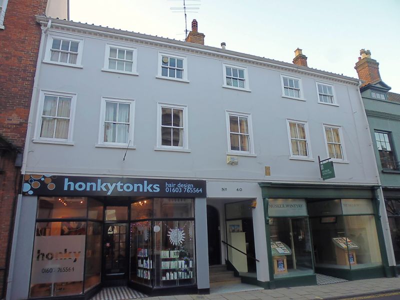
Entry Name: 40, St Giles Street
Listing Date: 5 June 1972
Grade: II
Source: Historic England
Source ID: 1051840
English Heritage Legacy ID: 229550
ID on this website: 101051840
Location: Chapelfield Grove, Norwich, Norfolk, NR2
County: Norfolk
District: Norwich
Electoral Ward/Division: Mancroft
Parish: Non Civil Parish
Built-Up Area: Norwich
Traditional County: Norfolk
Lieutenancy Area (Ceremonial County): Norfolk
Church of England Parish: Norwich St Giles
Church of England Diocese: Norwich
Tagged with: Building
TG 2208 NE
15/776
5.6.72
ST. GILES STREET
(south side)
No. 40
GV II
Shops with flat above. Early C19 with C20 alterations. Rendered. Pantile roof.
3 storeys. 6 first floor windows. Central door recessed between two C20 shop-
fronts each with central recessed door. Sash windows throughout with plain
surrounds. Bracket cornice.
Listing NGR: TG2271108570
External links are from the relevant listing authority and, where applicable, Wikidata. Wikidata IDs may be related buildings as well as this specific building. If you want to add or update a link, you will need to do so by editing the Wikidata entry.


Other nearby listed buildings
