Approximate Location Map
Large Map »
Latitude: 52.5172 / 52°31'1"N
Longitude: -0.7251 / 0°43'30"W
OS Eastings: 486609
OS Northings: 291797
OS Grid: SP866917
Mapcode National: GBR CTJ.3J9
Mapcode Global: VHDQQ.DZ1Q
Plus Code: 9C4XG78F+VX
Entry Name: 28, A6003
Listing Date: 25 October 1951
Grade: II
Source: Historic England
Source ID: 1286243
English Heritage Legacy ID: 229914
ID on this website: 101286243
Location: Rockingham, North Northamptonshire, LE16
County: North Northamptonshire
Civil Parish: Rockingham
Traditional County: Northamptonshire
Lieutenancy Area (Ceremonial County): Northamptonshire
Church of England Parish: Rockingham
Church of England Diocese: Peterborough
Tagged with: Building
SP8691
12/132
25/10/51
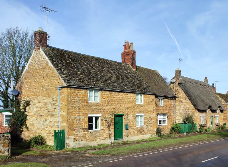
ROCKINGHAM
A6003
(West side)
No.28
GV II
House. Late C18. Squared coursed ironstone with Collyweston slate roof.
Originally 2-unit plan. 2 storeys. 3-window range of C19 casements under wood
lintels. C19 plank door under wood lintel to centre. Brick stacks at ends.
Interior not inspected.
Listing NGR: SP8660991797
External links are from the relevant listing authority and, where applicable, Wikidata. Wikidata IDs may be related buildings as well as this specific building. If you want to add or update a link, you will need to do so by editing the Wikidata entry.


Other nearby listed buildings
