Approximate Location Map
Large Map »
Latitude: 52.4807 / 52°28'50"N
Longitude: -0.4665 / 0°27'59"W
OS Eastings: 504238
OS Northings: 288083
OS Grid: TL042880
Mapcode National: GBR FXX.GVP
Mapcode Global: VHFNH.VXQ4
Plus Code: 9C4XFGJM+79
Entry Name: 1, St Osyth's Lane
Listing Date: 7 June 1974
Grade: II
Source: Historic England
Source ID: 1039806
English Heritage Legacy ID: 231782
ID on this website: 101039806
Location: Oundle, North Northamptonshire, PE8
County: North Northamptonshire
Civil Parish: Oundle
Built-Up Area: Oundle
Traditional County: Northamptonshire
Lieutenancy Area (Ceremonial County): Northamptonshire
Church of England Parish: Oundlew Ashton
Church of England Diocese: Peterborough
Tagged with: Building
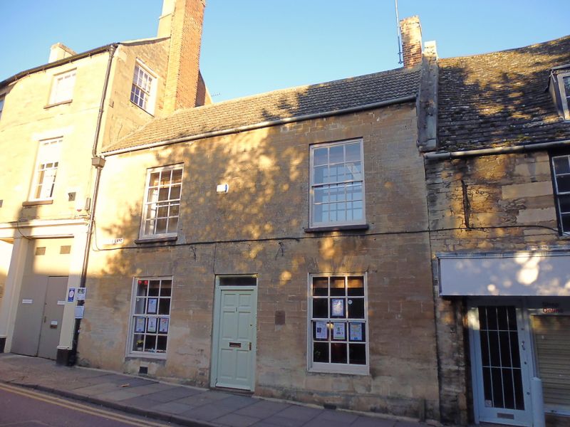
ST OSYTH'S LANE
1. (East Side)
1483 ---------------
No 1 1
TL 0488 1/99
II GV
2.
Late C18. 2 storeys in ashlar with modern cement tile roof. 2 windows to both
floors, hung sashes in shallow reveals, flat arched heads. Central doorway, moder
door.
Nos 1 to 4 (consec) forn a group.
Listing NGR: TL0423888083
External links are from the relevant listing authority and, where applicable, Wikidata. Wikidata IDs may be related buildings as well as this specific building. If you want to add or update a link, you will need to do so by editing the Wikidata entry.


Other nearby listed buildings
