Approximate Location Map
Large Map »
Latitude: 52.2362 / 52°14'10"N
Longitude: -0.897 / 0°53'49"W
OS Eastings: 475419
OS Northings: 260349
OS Grid: SP754603
Mapcode National: GBR BW8.VCM
Mapcode Global: VHDS5.D2N2
Plus Code: 9C4X64P3+F5
Entry Name: 19, Bridge Street
Listing Date: 22 January 1976
Grade: II
Source: Historic England
Source ID: 1372149
English Heritage Legacy ID: 231952
ID on this website: 101372149
Location: Northampton, West Northamptonshire, NN1
County: West Northamptonshire
Electoral Ward/Division: Castle
Parish: Northampton
Built-Up Area: Northampton
Traditional County: Northamptonshire
Lieutenancy Area (Ceremonial County): Northamptonshire
Church of England Parish: Northampton All Saints with St Katherine
Church of England Diocese: Peterborough
Tagged with: Building
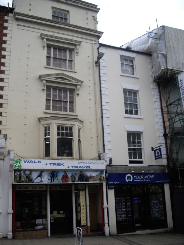
BRIDGE STREET
1.
5327
(East Side)
No 19
SP 7560 SW 3/380
II GV
2.
Early Cl9. Stucco, Welsh slated roof. 4 storeys, quoins. 1 sash window with
glazing bars under rusticated flat arches to each upper floor. Modern shop window.
Nos 7 to 23 (odd) form a group.
Listing NGR: SP7541960349
External links are from the relevant listing authority and, where applicable, Wikidata. Wikidata IDs may be related buildings as well as this specific building. If you want to add or update a link, you will need to do so by editing the Wikidata entry.


Other nearby listed buildings
