Approximate Location Map
Large Map »
Latitude: 52.2381 / 52°14'17"N
Longitude: -0.8971 / 0°53'49"W
OS Eastings: 475408
OS Northings: 260568
OS Grid: SP754605
Mapcode National: GBR BW8.N0D
Mapcode Global: VHDS5.D0LK
Plus Code: 9C4X64Q3+75
Entry Name: 42 and 44, the Drapery
Listing Date: 19 January 1952
Grade: II
Source: Historic England
Source ID: 1372204
English Heritage Legacy ID: 232032
ID on this website: 101372204
Location: Northampton, West Northamptonshire, NN1
County: West Northamptonshire
Electoral Ward/Division: Castle
Parish: Northampton
Built-Up Area: Northampton
Traditional County: Northamptonshire
Lieutenancy Area (Ceremonial County): Northamptonshire
Church of England Parish: Northampton All Saints with St Katherine
Church of England Diocese: Peterborough
Tagged with: Building
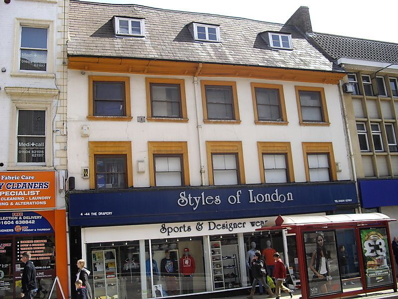
THE DRAPERY
1.
5327
(East Side)
Nos 42 & 44
SP 7560 NW 1/50 19.1.52.
II
2.
C18. Cement rendered front, Welsh slated roof with 3 dormers. 3 storeys and attics,
5 sash windows in architrave surrounds. C19 shop front.
Listing NGR: SP7540860568
External links are from the relevant listing authority and, where applicable, Wikidata. Wikidata IDs may be related buildings as well as this specific building. If you want to add or update a link, you will need to do so by editing the Wikidata entry.


Other nearby listed buildings
