Approximate Location Map
Large Map »
Latitude: 52.2408 / 52°14'26"N
Longitude: -0.898 / 0°53'52"W
OS Eastings: 475345
OS Northings: 260859
OS Grid: SP753608
Mapcode National: GBR BW8.FSP
Mapcode Global: VHDRZ.DY43
Plus Code: 9C4X64R2+8R
Entry Name: 56A and 56B, Sheep Street
Listing Date: 9 December 1968
Grade: II
Source: Historic England
Source ID: 1191191
English Heritage Legacy ID: 232216
ID on this website: 101191191
Location: Northampton, West Northamptonshire, NN1
County: West Northamptonshire
Electoral Ward/Division: Castle
Parish: Northampton
Built-Up Area: Northampton
Traditional County: Northamptonshire
Lieutenancy Area (Ceremonial County): Northamptonshire
Church of England Parish: Northampton Holy Sepulchre with S Andrew and St Lawrence
Church of England Diocese: Peterborough
Tagged with: Building
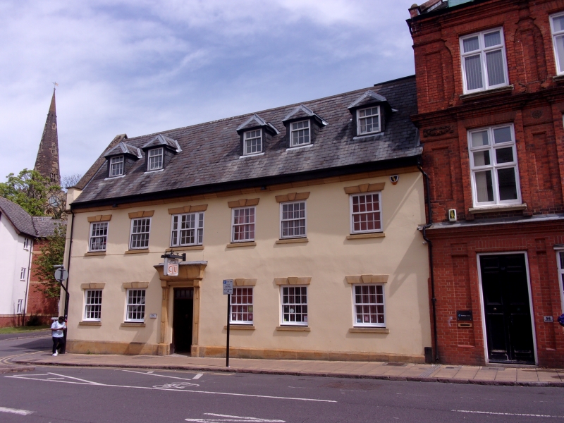
SHEEP STREET
1.
5327
(East side)
Nos 56A & 56B
SP 7560 NW 1/92 9.12.68.
II
2.
C17 and later. Ashlar, interlocking tiled roof with stone cornice. 2 storeys,
6 sash windows. Shop front.
Listing NGR: SP7534560858
External links are from the relevant listing authority and, where applicable, Wikidata. Wikidata IDs may be related buildings as well as this specific building. If you want to add or update a link, you will need to do so by editing the Wikidata entry.


Other nearby listed buildings
