Approximate Location Map
Large Map »
Latitude: 52.6152 / 52°36'54"N
Longitude: -0.5327 / 0°31'57"W
OS Eastings: 499440
OS Northings: 302948
OS Grid: SK994029
Mapcode National: GBR FW8.43F
Mapcode Global: WHGM2.SJJG
Plus Code: 9C4XJF88+3W
Entry Name: The Poplars
Listing Date: 23 May 1967
Last Amended: 31 March 1988
Grade: II
Source: Historic England
Source ID: 1371972
English Heritage Legacy ID: 232896
ID on this website: 101371972
Location: Collyweston, North Northamptonshire, PE9
County: North Northamptonshire
Civil Parish: Collyweston
Built-Up Area: Collyweston
Traditional County: Northamptonshire
Lieutenancy Area (Ceremonial County): Northamptonshire
Church of England Parish: Collyweston St Andrew
Church of England Diocese: Peterborough
Tagged with: Architectural structure
COLLYWESTON BACK LANE
SK9902 (North side)
8/33 The Poplars
23/05/67 (Formerly listed as House W of
Manor Farmhouse)
GV II
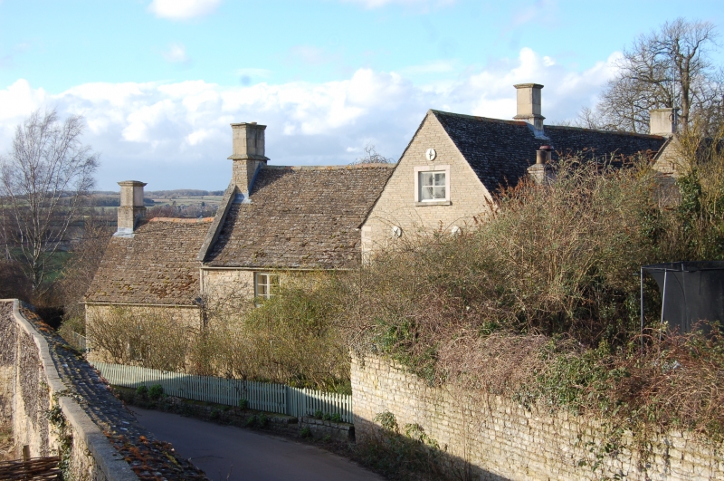
House. C17 with datestone BM/1625, late C18/early C19. Squared coursed limestone
with Collyweston slate roof. Originally 3-unit now L-shape plan. 2 storeys with
attic. Main front is a 3-window range of C19 unhorned sash windows. Ground floor
windows are tripartite sashes with glazing bars, first floor flanking windows
are 8-aned sashes and first floor centre window has margin lights; all with
plastered and painted surrounds. Double, 6-panel doors have moulded stone
surround keyblock and cornice. Shallow flight of moulded steps to door. Pair of
hipped eaves dormers with sash windows. Ashlar gable parapets, to left, and
aslar ridge and end stacks, with moulded cornices.2-window range breaks
forward, to right, at a lower eaves level to the main range. C19 sash and
casement windows under wood lintels. 2 single-light windows, now blocked, in
gable end. Datestone in apex of gable. Ashlar gable parapets and ashlar stack at
end. One-unit single-storey extension, attached to gable end, has ashlar end
stack. Elevation to left, abutting road, has some C19 casement windows with
ashlar surrounds and keyblocks and one 2-light stone mullion window. Interior
not inspected but probably has remains of open fireplaces.
(RCHM: An Inventory of Architectural Monuments in forth Northamptonshire: p34)
Listing NGR: SK9944002948
External links are from the relevant listing authority and, where applicable, Wikidata. Wikidata IDs may be related buildings as well as this specific building. If you want to add or update a link, you will need to do so by editing the Wikidata entry.


Other nearby listed buildings
