Approximate Location Map
Large Map »
Latitude: 52.0315 / 52°1'53"N
Longitude: -1.1422 / 1°8'32"W
OS Eastings: 458941
OS Northings: 237358
OS Grid: SP589373
Mapcode National: GBR 8VT.L16
Mapcode Global: VHCWK.46ZH
Plus Code: 9C4W2VJ5+J4
Entry Name: 15 and 16, Church Road
Listing Date: 16 June 1977
Grade: II
Source: Historic England
Source ID: 1040570
English Heritage Legacy ID: 233828
ID on this website: 101040570
Location: Brackley, West Northamptonshire, NN13
County: West Northamptonshire
Civil Parish: Brackley
Built-Up Area: Brackley
Traditional County: Northamptonshire
Lieutenancy Area (Ceremonial County): Northamptonshire
Church of England Parish: Brackley
Church of England Diocese: Peterborough
Tagged with: Building Thatched cottage
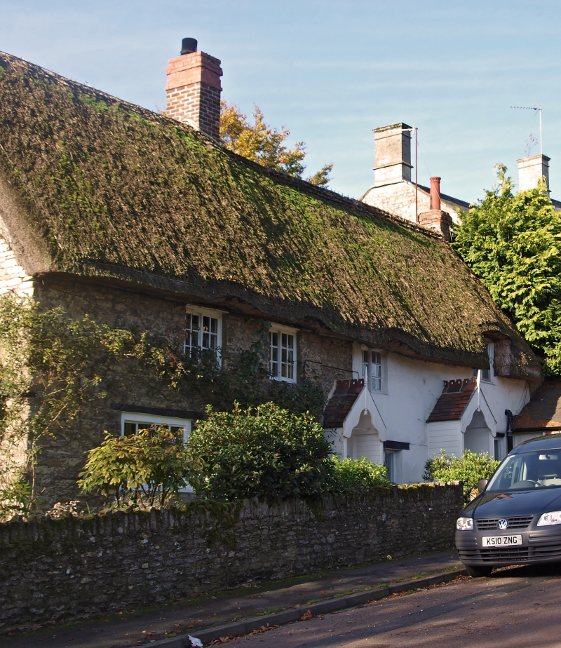
BRACKLEY CHURCH ROAD
1.
5328
Nos 15 and 16
SP 5837 2/44
II
2.
2 cottages. One building. Originally C17-18 but altered in C19. 2-storeyed
coursed rubble with thatch roof and brick stacks. Casement windows with sliding
lights.
Listing NGR: SP5894137358
External links are from the relevant listing authority and, where applicable, Wikidata. Wikidata IDs may be related buildings as well as this specific building. If you want to add or update a link, you will need to do so by editing the Wikidata entry.


Other nearby listed buildings
