Approximate Location Map
Large Map »
Latitude: 55.4175 / 55°25'2"N
Longitude: -1.7094 / 1°42'33"W
OS Eastings: 418496
OS Northings: 613765
OS Grid: NU184137
Mapcode National: GBR J5HS.QT
Mapcode Global: WHC1K.Q367
Plus Code: 9C7WC78R+X7
Entry Name: Retaining Walls
Listing Date: 25 August 1977
Grade: II
Source: Historic England
Source ID: 1178700
English Heritage Legacy ID: 235866
ID on this website: 101178700
Location: Alnwick, Northumberland, NE66
County: Northumberland
Civil Parish: Alnwick
Built-Up Area: Alnwick
Traditional County: Northumberland
Lieutenancy Area (Ceremonial County): Northumberland
Church of England Parish: Alnwick
Church of England Diocese: Newcastle
Tagged with: Retaining wall
WALKERGATE
1.
5330
(South Side)
Retaining walls
NU 1813 NE 2/388
NU 1813 NW 3/388
II
2.
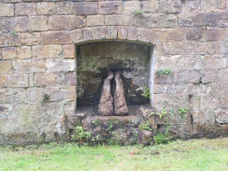
Probably early C19. About 200 yds in all; 1st 100 yds rubble built about 5 ft
high; rest ashlar about 9 ft high garden vail with a recessed fountain to east
of centre and a double door under segmental archway at east end.
Listing NGR: NU1850413765
External links are from the relevant listing authority and, where applicable, Wikidata. Wikidata IDs may be related buildings as well as this specific building. If you want to add or update a link, you will need to do so by editing the Wikidata entry.


Other nearby listed buildings
