Approximate Location Map
Large Map »
Latitude: 55.0624 / 55°3'44"N
Longitude: -1.5038 / 1°30'13"W
OS Eastings: 431792
OS Northings: 574329
OS Grid: NZ317743
Mapcode National: GBR K9YX.72
Mapcode Global: WHC3D.W03W
Plus Code: 9C7W3F6W+XF
Entry Name: Footbridge on West of Road Bridge over Seaton Burn
Listing Date: 15 July 1987
Grade: II
Source: Historic England
Source ID: 1154544
English Heritage Legacy ID: 235975
ID on this website: 101154544
Location: Holywell, Northumberland, NE25
County: Northumberland
Civil Parish: Seaton Valley
Traditional County: Northumberland
Lieutenancy Area (Ceremonial County): Northumberland
Church of England Parish: Earsdon and Backworth
Church of England Diocese: Newcastle
Tagged with: Footbridge
A 192, Holywell
NZ 37 SW
Whitley Bay
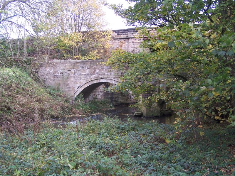
8/11 Footbridge on west
of road bridge
over Seaton Burn
II
Bridge, C17 or early C18 with parapets rebuilt later. Squared stone. 2
segmental arches divided by triangular cutwater dying into shallow pilaster
buttress. Parapets with chamfered coping splay out to damaged end piers.
Listing NGR: NZ3179274329
External links are from the relevant listing authority and, where applicable, Wikidata. Wikidata IDs may be related buildings as well as this specific building. If you want to add or update a link, you will need to do so by editing the Wikidata entry.


Other nearby listed buildings
