Approximate Location Map
Large Map »
Latitude: 55.3444 / 55°20'39"N
Longitude: -2.1192 / 2°7'9"W
OS Eastings: 392537
OS Northings: 605601
OS Grid: NT925056
Mapcode National: GBR F6MN.Z0
Mapcode Global: WHB0F.FX2S
Plus Code: 9C7V8VVJ+Q8
Entry Name: Limekiln Circa 200 Yards North West of Park House
Listing Date: 3 September 1986
Grade: II
Source: Historic England
Source ID: 1371425
English Heritage Legacy ID: 236177
ID on this website: 101371425
Location: Alwinton, Northumberland, NE65
County: Northumberland
Civil Parish: Harbottle
Traditional County: Northumberland
Lieutenancy Area (Ceremonial County): Northumberland
Church of England Parish: Upper Coquetdale
Church of England Diocese: Newcastle
Tagged with: Lime kiln
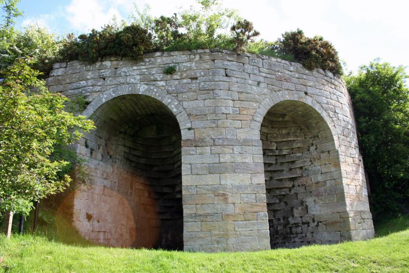
HARBOTTLE LOW ALWINTON
NT 90 NW
14/90 Limekiln c.200 yards
north-west of
Park House
II
Limekiln. Early C19. Dressed stone. Artificial mound containing stone-lined
pot. Canted screen wall with 3 high semicircular arches. Internally these are
deeply splayed with many corbels leading to small square draw holes.
Listing NGR: NT9253705601
External links are from the relevant listing authority and, where applicable, Wikidata. Wikidata IDs may be related buildings as well as this specific building. If you want to add or update a link, you will need to do so by editing the Wikidata entry.


Other nearby listed buildings
