Approximate Location Map
Large Map »
Latitude: 55.2321 / 55°13'55"N
Longitude: -2.1012 / 2°6'4"W
OS Eastings: 393660
OS Northings: 593101
OS Grid: NY936931
Mapcode National: GBR F7RY.W8
Mapcode Global: WHB10.PRMC
Plus Code: 9C7V6VJX+RG
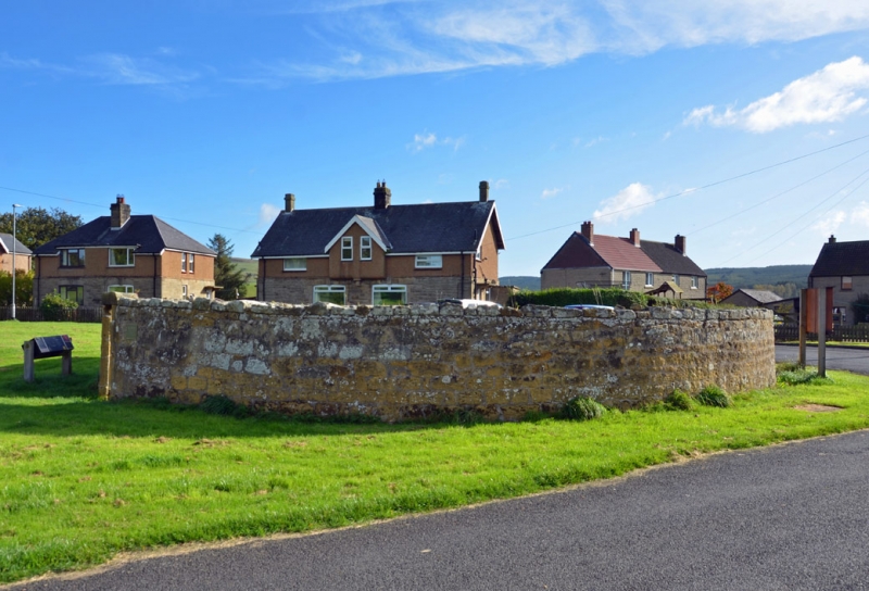
Entry Name: The Pinfold
Listing Date: 29 May 1987
Grade: II
Source: Historic England
Source ID: 1041235
English Heritage Legacy ID: 236254
ID on this website: 101041235
Location: Elsdon, Northumberland, NE19
County: Northumberland
Civil Parish: Elsdon
Traditional County: Northumberland
Lieutenancy Area (Ceremonial County): Northumberland
Church of England Parish: Elsdon St Cuthbert
Church of England Diocese: Newcastle
Tagged with: Building
ELSDON ELSDON
NY 9393
19/15 The Pinfold
GV II
Stray animal pound. Probably C18. Random rubble. Round, c.40 ft. diameter.
Walls c. 7 ft. high with large, rough coping stones. Doorway on north side has
large stone lintel.
Listing NGR: NY9366093100
External links are from the relevant listing authority and, where applicable, Wikidata. Wikidata IDs may be related buildings as well as this specific building. If you want to add or update a link, you will need to do so by editing the Wikidata entry.


Other nearby listed buildings
