Approximate Location Map
Large Map »
Latitude: 55.3475 / 55°20'51"N
Longitude: -1.612 / 1°36'43"W
OS Eastings: 424705
OS Northings: 606011
OS Grid: NU247060
Mapcode National: GBR K65L.TW
Mapcode Global: WHC1T.6VND
Plus Code: 9C7W89XQ+26
Entry Name: Pant Outside Number 19
Listing Date: 1 September 1988
Grade: II
Source: Historic England
Source ID: 1303536
English Heritage Legacy ID: 237176
ID on this website: 101303536
Location: Warkworth, Northumberland, NE65
County: Northumberland
Civil Parish: Warkworth
Built-Up Area: Warkworth
Traditional County: Northumberland
Lieutenancy Area (Ceremonial County): Northumberland
Church of England Parish: Warkworth St Lawrence
Church of England Diocese: Newcastle
Tagged with: Drinking fountain
NU 2406
21/285
WARKWORTH
CASTLE STREET
(West side)
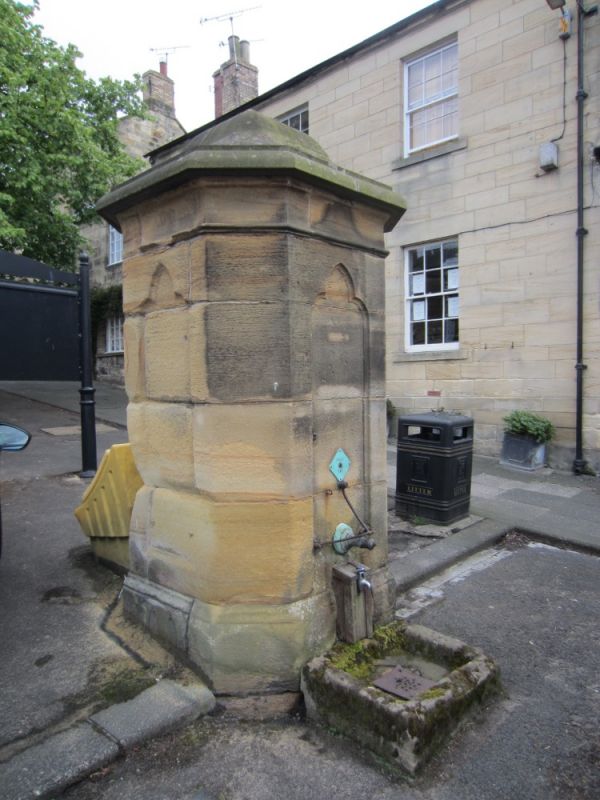
Pant outside No. 19
GV
II
Pant. Late C18 or early C19. Ashlar. Square plan with chamfered angles.
Plinth. Three faces have sunk trefoil-headed panels; front with old bronze
tap fitting. Moulded cornice; swept domed top. Boarded hatch on right return.
Low stone trough with bucket-rest bar.
Listing NGR: NU2470506011
External links are from the relevant listing authority and, where applicable, Wikidata. Wikidata IDs may be related buildings as well as this specific building. If you want to add or update a link, you will need to do so by editing the Wikidata entry.


Other nearby listed buildings
