Approximate Location Map
Large Map »
Latitude: 55.3484 / 55°20'54"N
Longitude: -1.6119 / 1°36'42"W
OS Eastings: 424710
OS Northings: 606114
OS Grid: NU247061
Mapcode National: GBR K65L.TK
Mapcode Global: WHC1T.6TPP
Plus Code: 9C7W89XQ+96
Entry Name: 19, Dial Place
Listing Date: 31 December 1969
Grade: II
Source: Historic England
Source ID: 1371234
English Heritage Legacy ID: 237196
ID on this website: 101371234
Location: Warkworth, Northumberland, NE65
County: Northumberland
Civil Parish: Warkworth
Built-Up Area: Warkworth
Traditional County: Northumberland
Lieutenancy Area (Ceremonial County): Northumberland
Church of England Parish: Warkworth St Lawrence
Church of England Diocese: Newcastle
Tagged with: Building
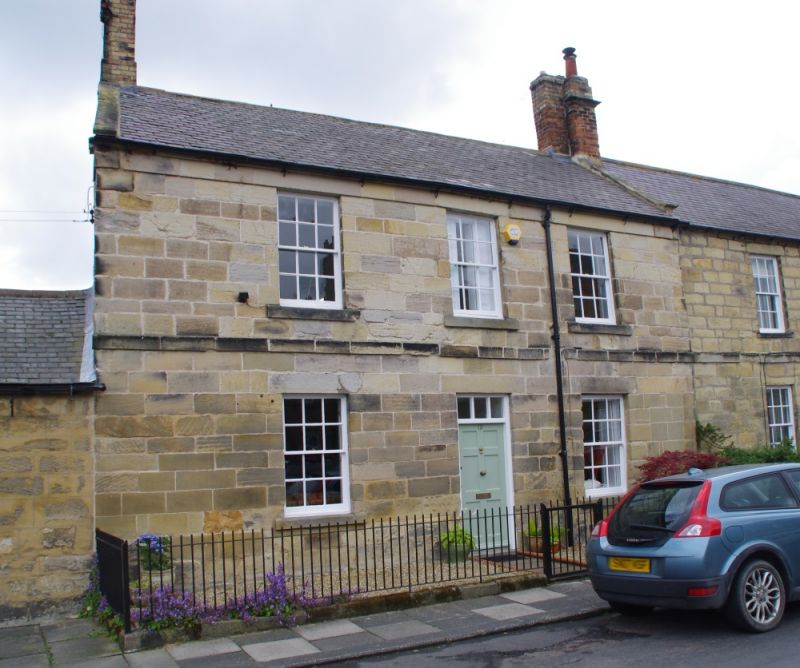
NU 2406 WARKWORTH DIAL PLACE
(East side)
21/305 No. 19
31.12.69
GV II
House, early C19. Squared tooled stone; Welsh slate roof with C20 brick stacks.
2 storeys, 3 slightly-irregular bays. 1st floor band. Central renewed 6-
panel door with 3-pane overlight. 12-pane sash windows with slightly-
projecting sills. Eaves band. Coped left gable; end stacks.
Listing NGR: NU2471006117
External links are from the relevant listing authority and, where applicable, Wikidata. Wikidata IDs may be related buildings as well as this specific building. If you want to add or update a link, you will need to do so by editing the Wikidata entry.


Other nearby listed buildings
