Approximate Location Map
Large Map »
Latitude: 55.7716 / 55°46'17"N
Longitude: -2.0072 / 2°0'25"W
OS Eastings: 399645
OS Northings: 653145
OS Grid: NT996531
Mapcode National: GBR G1FP.7V
Mapcode Global: WH9YK.46G6
Plus Code: 9C7VQXCV+M4
Entry Name: 4-8, Castlegate
Listing Date: 26 May 1971
Grade: II
Source: Historic England
Source ID: 1290156
English Heritage Legacy ID: 237294
ID on this website: 101290156
Location: Berwick-upon-Tweed, Northumberland, TD15
County: Northumberland
Civil Parish: Berwick-upon-Tweed
Built-Up Area: Berwick-upon-Tweed
Traditional County: Northumberland
Lieutenancy Area (Ceremonial County): Northumberland
Church of England Parish: Berwick Holy Trinity and St Mary
Church of England Diocese: Newcastle
Tagged with: Building
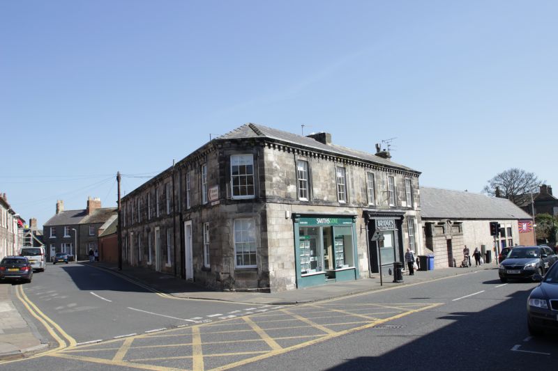
1.
840 CASTLEGATE
(North Side)
Nos 4 to 8 (even)
NT 9953 11/39
II
2.
Part of the same mid-Cl9 corner block as Nos 1, 2, 3 St Mary's Place. A
good mid-Cl9 block on corner site. 2 storeys. Ashlar, with architraves,
block cornice, and 3 modern shop fronts. Canted comer at No 8 but
original entrance now removed.
Listing NGR: NT9964553145
External links are from the relevant listing authority and, where applicable, Wikidata. Wikidata IDs may be related buildings as well as this specific building. If you want to add or update a link, you will need to do so by editing the Wikidata entry.


Other nearby listed buildings
