Approximate Location Map
Large Map »
Latitude: 55.1722 / 55°10'19"N
Longitude: -1.6939 / 1°41'38"W
OS Eastings: 419592
OS Northings: 586470
OS Grid: NZ195864
Mapcode National: GBR J8MM.2Q
Mapcode Global: WHC2Q.Y8J9
Plus Code: 9C7W58C4+VC
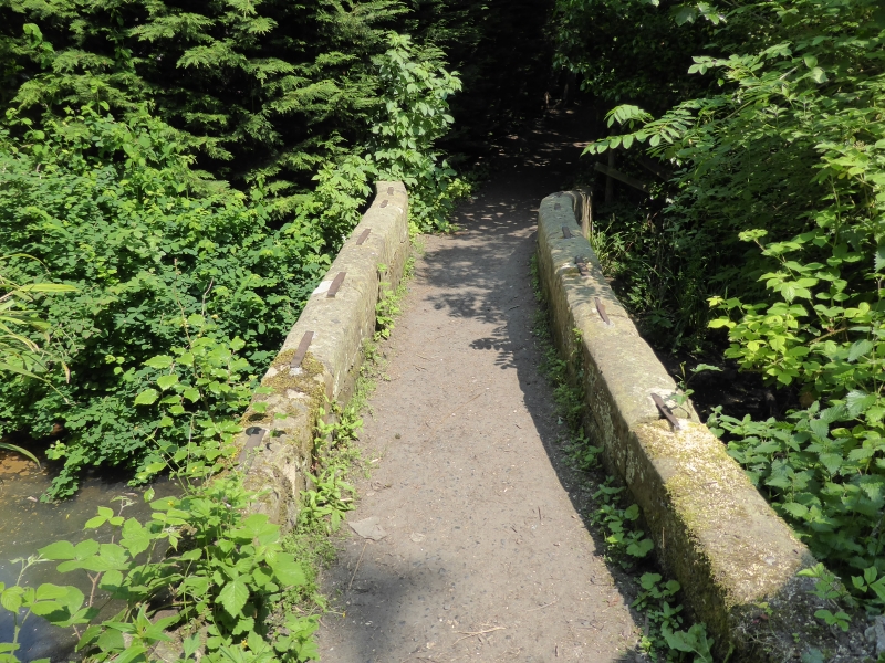
Entry Name: Footbridge on Beggar's Lane
Listing Date: 22 August 1986
Grade: II
Source: Historic England
Source ID: 1155607
English Heritage Legacy ID: 238698
ID on this website: 101155607
Location: Morpeth, Northumberland, NE61
County: Northumberland
Civil Parish: Morpeth
Built-Up Area: Morpeth
Traditional County: Northumberland
Lieutenancy Area (Ceremonial County): Northumberland
Church of England Parish: Morpeth
Church of England Diocese: Newcastle
Tagged with: Footbridge
MORPETH BULLER'S GREEN (off)
NZ 1986 (East side)
22/213
Footbridge on
Beggar's Lane
II
Footbridge. C18. Brick and ashlar. Low brick segmental arch. Plain parapet
which splays out sharply on east side.
Listing NGR: NZ1959286470
External links are from the relevant listing authority and, where applicable, Wikidata. Wikidata IDs may be related buildings as well as this specific building. If you want to add or update a link, you will need to do so by editing the Wikidata entry.


Other nearby listed buildings
