Approximate Location Map
Large Map »
Latitude: 54.9767 / 54°58'36"N
Longitude: -2.0942 / 2°5'38"W
OS Eastings: 394070
OS Northings: 564678
OS Grid: NY940646
Mapcode National: GBR FBTW.FS
Mapcode Global: WHB2C.S5ZN
Plus Code: 9C6VXWG4+M8
Entry Name: Hexham Bridge
Listing Date: 2 October 1951
Grade: II*
Source: Historic England
Source ID: 1042629
English Heritage Legacy ID: 239008
ID on this website: 101042629
Location: Bridge End, Northumberland, NE46
County: Northumberland
Civil Parish: Hexham
Built-Up Area: Hexham
Traditional County: Northumberland
Lieutenancy Area (Ceremonial County): Northumberland
Church of England Parish: St John Lee
Church of England Diocese: Newcastle
Tagged with: Road bridge
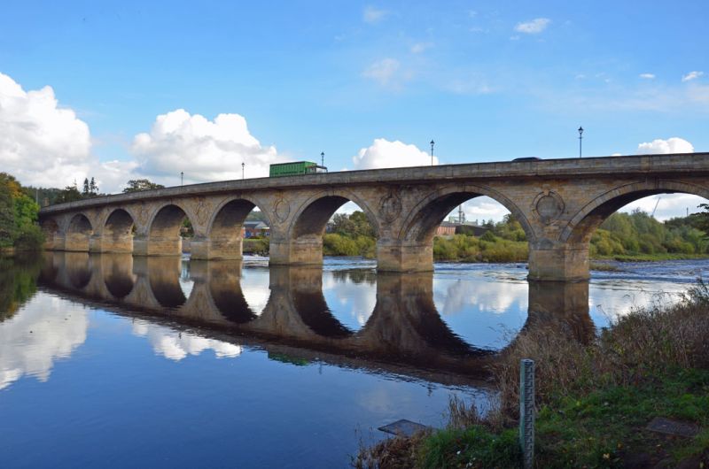
Hexham Bridge
1.
5334
NY 9464 10/109 2.10.51.
II*
2.
1793. Fifth bridge built within 30 years of each other; previous ones destroyed
by flood. 9 arched stone bridge designed by engineer-architect Robert Mylne.
Blind oculi with 4 keystones in spandrels of arches. AM.
Listing NGR: NY9407064678
External links are from the relevant listing authority and, where applicable, Wikidata. Wikidata IDs may be related buildings as well as this specific building. If you want to add or update a link, you will need to do so by editing the Wikidata entry.


Other nearby listed buildings
