Approximate Location Map
Large Map »
Latitude: 54.9698 / 54°58'11"N
Longitude: -2.1014 / 2°6'5"W
OS Eastings: 393605
OS Northings: 563917
OS Grid: NY936639
Mapcode National: GBR FBRZ.V7
Mapcode Global: WHB2C.PBJW
Plus Code: 9C6VXV9X+WC
Entry Name: 4, Battlehill
Listing Date: 2 October 1951
Grade: II
Source: Historic England
Source ID: 1042603
English Heritage Legacy ID: 239035
ID on this website: 101042603
Location: Hexham, Northumberland, NE46
County: Northumberland
Civil Parish: Hexham
Built-Up Area: Hexham
Traditional County: Northumberland
Lieutenancy Area (Ceremonial County): Northumberland
Church of England Parish: Hexham
Church of England Diocese: Newcastle
Tagged with: Building
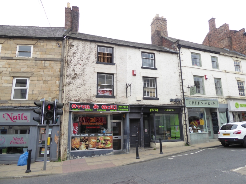
BATTLEHILL
1. (South Side)
5334
No 4
NY 9363 2/77 2.10.51.
II GV
2.
Early C19. 3 storeys. 2 windows. Painted brick with stone lintels and cills.
Glazing bar sash windows except to left of 1st floor, single hung on 2nd floor.
Late C19 small shop front to right with 2 carved fascia brackets. Through
passage to outhouse terrace at rear. Modern shop front to left.
Nos 2 to 8 (even) form a group.
Listing NGR: NY9360563917
External links are from the relevant listing authority and, where applicable, Wikidata. Wikidata IDs may be related buildings as well as this specific building. If you want to add or update a link, you will need to do so by editing the Wikidata entry.


Other nearby listed buildings
