Approximate Location Map
Large Map »
Latitude: 54.9718 / 54°58'18"N
Longitude: -2.1032 / 2°6'11"W
OS Eastings: 393492
OS Northings: 564136
OS Grid: NY934641
Mapcode National: GBR FBRY.GK
Mapcode Global: WHB2C.N9PD
Plus Code: 9C6VXVCW+PP
Entry Name: Archway to Church Flags Archway to Cowgarth
Listing Date: 18 May 1976
Grade: II
Source: Historic England
Source ID: 1042613
English Heritage Legacy ID: 239057
ID on this website: 101042613
Location: Hexham, Northumberland, NE46
County: Northumberland
Civil Parish: Hexham
Built-Up Area: Hexham
Traditional County: Northumberland
Lieutenancy Area (Ceremonial County): Northumberland
Church of England Parish: Hexham
Church of England Diocese: Newcastle
Tagged with: Archway
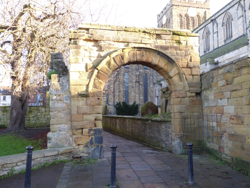
CHURCH FLAGS
1.
5334 Archway to Cowgarth
NY 9364 1/183
II GV
2.
C12 or C13 opposite west end of nave. Moulded dripmould to arch. Repaired
parapet.
Archway to Cowgarth and the adjacent wall and St Andrew's Priory Church form a group.
Listing NGR: NY9349264136
External links are from the relevant listing authority and, where applicable, Wikidata. Wikidata IDs may be related buildings as well as this specific building. If you want to add or update a link, you will need to do so by editing the Wikidata entry.


Other nearby listed buildings
