Approximate Location Map
Large Map »
Latitude: 54.9678 / 54°58'4"N
Longitude: -2.1057 / 2°6'20"W
OS Eastings: 393329
OS Northings: 563692
OS Grid: NY933636
Mapcode National: GBR FBQZ.XZ
Mapcode Global: WHB2C.MDHG
Plus Code: 9C6VXV9V+4P
Entry Name: Bridge on Path South of Cuddy's Lane, Also over Halgut Burn
Listing Date: 18 May 1976
Grade: II
Source: Historic England
Source ID: 1203691
English Heritage Legacy ID: 239069
ID on this website: 101203691
Location: Hexham, Northumberland, NE46
County: Northumberland
Civil Parish: Hexham
Built-Up Area: Hexham
Traditional County: Northumberland
Lieutenancy Area (Ceremonial County): Northumberland
Church of England Parish: Hexham
Church of England Diocese: Newcastle
Tagged with: Bridge
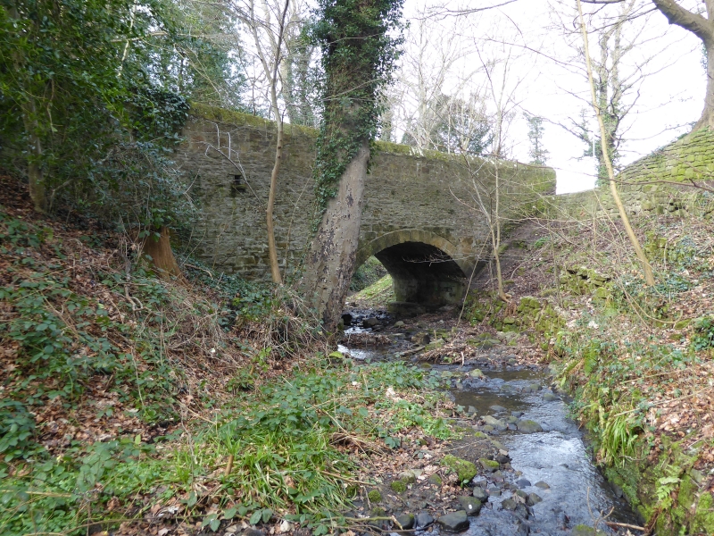
CUDDY'S LANE
1.
5334 Bridge on path south of
Cuddy's Lane, also over
Halgut Burn
NY 9363 2/197
II
2.
Mid C19. Rubble with ashlar dressings. Segmental arch to bridge. Short causeway
on each side.
Listing NGR: NY9332963692
External links are from the relevant listing authority and, where applicable, Wikidata. Wikidata IDs may be related buildings as well as this specific building. If you want to add or update a link, you will need to do so by editing the Wikidata entry.


Other nearby listed buildings
