Approximate Location Map
Large Map »
Latitude: 54.9709 / 54°58'15"N
Longitude: -2.1044 / 2°6'15"W
OS Eastings: 393413
OS Northings: 564041
OS Grid: NY934640
Mapcode National: GBR FBRY.6V
Mapcode Global: WHB2C.NB31
Plus Code: 9C6VXVCW+96
Entry Name: Bandstand
Listing Date: 18 May 1976
Grade: II
Source: Historic England
Source ID: 1370810
English Heritage Legacy ID: 239218
ID on this website: 101370810
Location: Abbey Grounds, Hexham, Northumberland, NE46
County: Northumberland
Civil Parish: Hexham
Built-Up Area: Hexham
Traditional County: Northumberland
Lieutenancy Area (Ceremonial County): Northumberland
Church of England Parish: Hexham
Church of England Diocese: Newcastle
Tagged with: Bandstand
THE SEAL OR SELE
1.
5334 Bandstand
NY 9364 1/329
II
2.
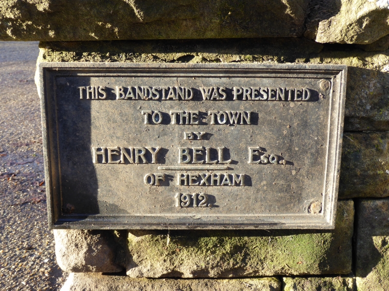
Dated 1912. Octagonal with tented lower roof slope supporting pointed cap with
gilt finial. 8 cast iron shafts with corinthian capitals and ornate scroll work
brackets. Star ribbed sounding board. Fringed eaves. Arcaded railings between
shafts. 1912 plaque commemorating gift of Henry Bell.
Listing NGR: NY9341564041
External links are from the relevant listing authority and, where applicable, Wikidata. Wikidata IDs may be related buildings as well as this specific building. If you want to add or update a link, you will need to do so by editing the Wikidata entry.


Other nearby listed buildings
