Approximate Location Map
Large Map »
Latitude: 55.1431 / 55°8'35"N
Longitude: -2.262 / 2°15'43"W
OS Eastings: 383399
OS Northings: 583230
OS Grid: NY833832
Mapcode National: GBR D8NZ.24
Mapcode Global: WHB1B.7Z4L
Plus Code: 9C7V4PVQ+76
Entry Name: Bellingham Bridge
Listing Date: 7 March 1985
Grade: II
Source: Historic England
Source ID: 1044990
English Heritage Legacy ID: 239386
ID on this website: 101044990
Location: Bellingham, Northumberland, NE48
County: Northumberland
Civil Parish: Bellingham
Traditional County: Northumberland
Lieutenancy Area (Ceremonial County): Northumberland
Church of England Parish: Bellingham
Church of England Diocese: Newcastle
Tagged with: Bridge
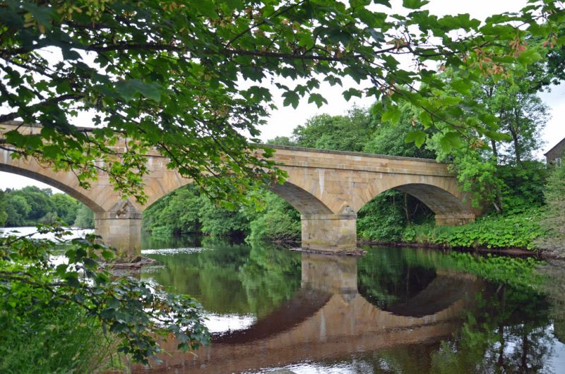
NY 8283 - 8383 BELLINGHAM B6320
21/1 Bellingham Bridge
GV II
Bridge. 1834 by John Green. Ashlar. 4 broad segmental arches separated by
triangular cutwaters. Broad band marks base of parapet which is capped by
chamfered coping.
Listing NGR: NY8339983230
External links are from the relevant listing authority and, where applicable, Wikidata. Wikidata IDs may be related buildings as well as this specific building. If you want to add or update a link, you will need to do so by editing the Wikidata entry.


Other nearby listed buildings
