Approximate Location Map
Large Map »
Latitude: 55.1765 / 55°10'35"N
Longitude: -2.1457 / 2°8'44"W
OS Eastings: 390815
OS Northings: 586922
OS Grid: NY908869
Mapcode National: GBR F8GL.75
Mapcode Global: WHB1D.04HY
Plus Code: 9C7V5VG3+JP
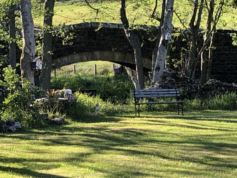
Entry Name: Chairford Bridge
Listing Date: 7 March 1985
Grade: II
Source: Historic England
Source ID: 1370446
English Heritage Legacy ID: 239439
ID on this website: 101370446
Location: East Woodburn, Northumberland, NE48
County: Northumberland
Civil Parish: Corsenside
Traditional County: Northumberland
Lieutenancy Area (Ceremonial County): Northumberland
Church of England Parish: Corsenside St Cuthbert
Church of England Diocese: Newcastle
Tagged with: Bridge
NY 98 NW CORSENSIDE EAST WOODBURN
3/59 Chairford Bridge
II
Bridge. Early C19. Dressed stone. Single segmental arch framed by arch
band. A hump-backed bridge; parapets have steeply ridged coping.
Listing NGR: NY9081586922
External links are from the relevant listing authority and, where applicable, Wikidata. Wikidata IDs may be related buildings as well as this specific building. If you want to add or update a link, you will need to do so by editing the Wikidata entry.


Other nearby listed buildings
