Approximate Location Map
Large Map »
Latitude: 54.9903 / 54°59'25"N
Longitude: -2.1044 / 2°6'15"W
OS Eastings: 393418
OS Northings: 566195
OS Grid: NY934661
Mapcode National: GBR FBRQ.6X
Mapcode Global: WHB25.NT3Q
Plus Code: 9C6VXVRW+46
Entry Name: Footbridge over the Birkey Burn 220 Metres South of Acomb House
Listing Date: 24 May 1988
Grade: II
Source: Historic England
Source ID: 1044846
English Heritage Legacy ID: 239764
ID on this website: 101044846
Location: Acomb, Northumberland, NE46
County: Northumberland
Civil Parish: Acomb
Traditional County: Northumberland
Lieutenancy Area (Ceremonial County): Northumberland
Church of England Parish: St John Lee
Church of England Diocese: Newcastle
Tagged with: Footbridge
ACOMB ACOMB
NY 9366 NY 934662
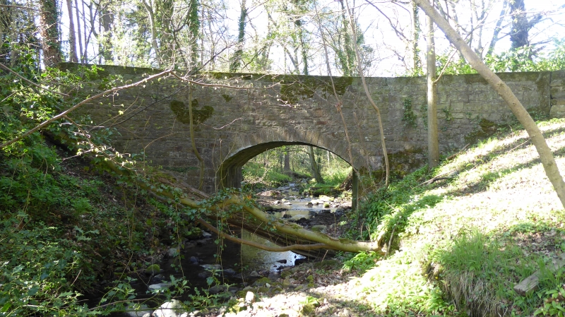
18/5 Footbridge over the
Birkey Burn 220
metres south of
Acomb House
II
Bridge, early C19 incorporating older fabric in south abutment. Rubble with
cut voussoirs and coping. Segmental arch. Parapet with flat coping of large
blocks linked by iron clamps, terminating in attached columns.
Listing NGR: NY9341866195
External links are from the relevant listing authority and, where applicable, Wikidata. Wikidata IDs may be related buildings as well as this specific building. If you want to add or update a link, you will need to do so by editing the Wikidata entry.


Other nearby listed buildings
