Approximate Location Map
Large Map »
Latitude: 53.2643 / 53°15'51"N
Longitude: -1.0627 / 1°3'45"W
OS Eastings: 462613
OS Northings: 374552
OS Grid: SK626745
Mapcode National: GBR PZ0P.QK
Mapcode Global: WHFGL.N64W
Plus Code: 9C5W7W7P+PW
Entry Name: Sundial to South of Vicarage
Listing Date: 1 April 1985
Grade: II
Source: Historic England
Source ID: 1370437
English Heritage Legacy ID: 241263
ID on this website: 101370437
Location: Bassetlaw, Nottinghamshire, S80
County: Nottinghamshire
District: Bassetlaw
Civil Parish: Clumber and Hardwick
Traditional County: Nottinghamshire
Lieutenancy Area (Ceremonial County): Nottinghamshire
Church of England Parish: Worksop Priory with Carburton
Church of England Diocese: Southwell and Nottingham
Tagged with: Sundial
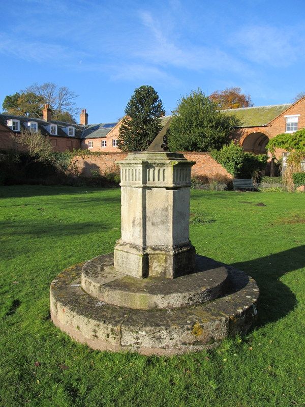
SK 67 SW WORKSOP CLUMBER PARK
5/53 Sundial to south
of Vicarage
G.V. II
Pillar sundial. Late C18. Ashlar with bronze dial. Round
plinth of 2 stages, cruciform shaft with relief panels and
cornice; octagonal cap. Included for group value only.
Listing NGR: SK6261374552
External links are from the relevant listing authority and, where applicable, Wikidata. Wikidata IDs may be related buildings as well as this specific building. If you want to add or update a link, you will need to do so by editing the Wikidata entry.


Other nearby listed buildings
