Approximate Location Map
Large Map »
Latitude: 52.9785 / 52°58'42"N
Longitude: -0.9279 / 0°55'40"W
OS Eastings: 472083
OS Northings: 342893
OS Grid: SK720428
Mapcode National: GBR BLB.682
Mapcode Global: WHFJ0.QDBF
Plus Code: 9C4XX3HC+CR
Entry Name: Whipping Post
Listing Date: 14 November 1986
Grade: II
Source: Historic England
Source ID: 1370113
English Heritage Legacy ID: 241772
ID on this website: 101370113
Location: Car Colston, Rushcliffe, Nottinghamshire, NG13
County: Nottinghamshire
District: Rushcliffe
Civil Parish: Car Colston
Traditional County: Nottinghamshire
Lieutenancy Area (Ceremonial County): Nottinghamshire
Church of England Parish: Car Colston
Church of England Diocese: Southwell and Nottingham
Tagged with: Architectural structure
CAR COLSTON off LARGE GREEN
SK 74 SW
(north side)
4/28
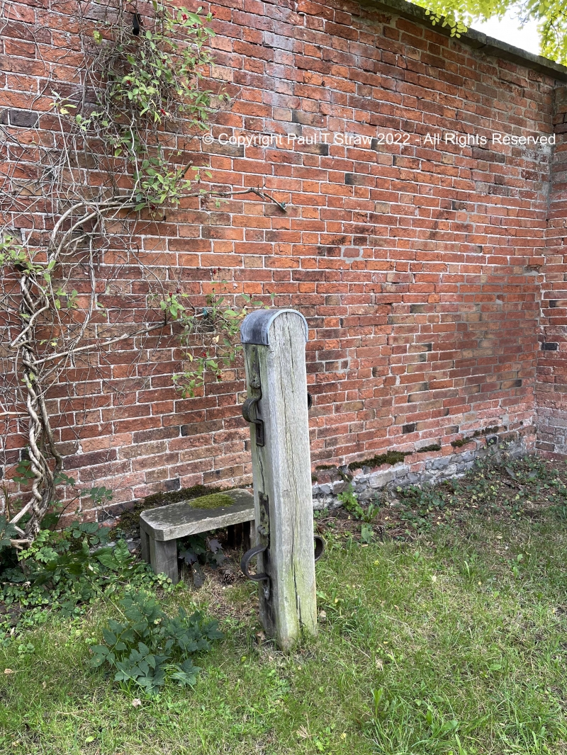
Whipping Post
G.V. II
Whipping post. Early C19. Chamfered square oak post with rounded
leaded top. 2 pairs iron manacles. Included for group value
only.
Listing NGR: SK7208342893
External links are from the relevant listing authority and, where applicable, Wikidata. Wikidata IDs may be related buildings as well as this specific building. If you want to add or update a link, you will need to do so by editing the Wikidata entry.


Other nearby listed buildings
