Approximate Location Map
Large Map »
Latitude: 53.1457 / 53°8'44"N
Longitude: -0.8509 / 0°51'3"W
OS Eastings: 476953
OS Northings: 361566
OS Grid: SK769615
Mapcode National: GBR BJ9.TYR
Mapcode Global: WHFH8.W6Z8
Plus Code: 9C5X44WX+7J
Entry Name: Village Pound
Listing Date: 19 September 1985
Grade: II
Source: Historic England
Source ID: 1045950
English Heritage Legacy ID: 242779
ID on this website: 101045950
Location: Norwell, Newark and Sherwood, Nottinghamshire, NG23
County: Nottinghamshire
District: Newark and Sherwood
Civil Parish: Norwell
Built-Up Area: Norwell
Traditional County: Nottinghamshire
Lieutenancy Area (Ceremonial County): Nottinghamshire
Church of England Parish: Norwell
Church of England Diocese: Southwell and Nottingham
Tagged with: Building
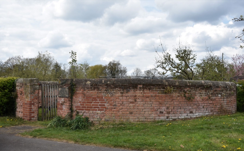
SK 76 SE NORWELL BATHLEY ROAD
(west side)
4/75 Village Pound
II
Cattle pound. C18. Brick with half round ashlar coping.
Circular wall with, to east, a pair of square gate piers with
ashlar capitals and C20 wooden gate. Approx. 10M diameter.
Listing NGR: SK7695361566
External links are from the relevant listing authority and, where applicable, Wikidata. Wikidata IDs may be related buildings as well as this specific building. If you want to add or update a link, you will need to do so by editing the Wikidata entry.


Other nearby listed buildings
