Approximate Location Map
Large Map »
Latitude: 51.9505 / 51°57'1"N
Longitude: -1.1774 / 1°10'38"W
OS Eastings: 456628
OS Northings: 228325
OS Grid: SP566283
Mapcode National: GBR 8WQ.P3T
Mapcode Global: VHCWX.J7WK
Plus Code: 9C3WXR2F+62
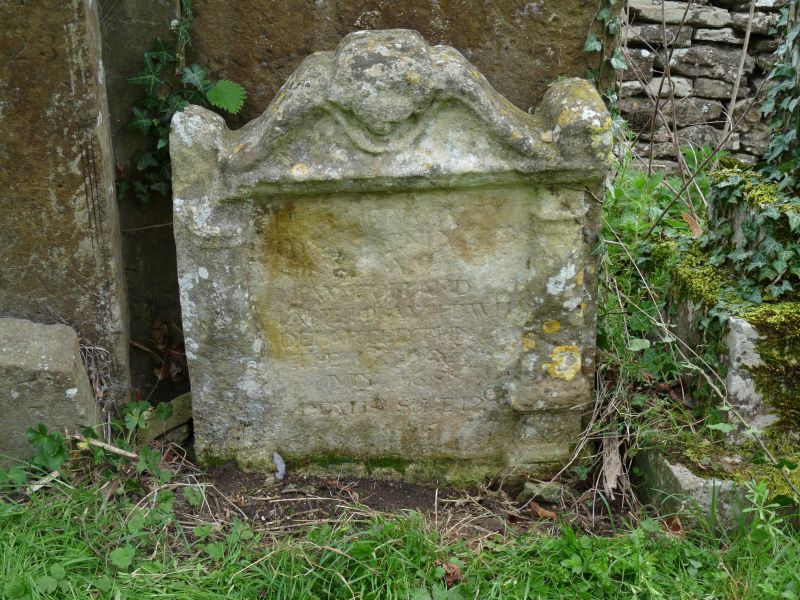
Entry Name: Headstone Dated 1699, Approximately 15 Metres South East of Tower, Church of St Peter
Listing Date: 3 October 1988
Grade: II
Source: Historic England
Source ID: 1193262
English Heritage Legacy ID: 243704
ID on this website: 101193262
Location: St Peter's Church, Stoke Lyne, Cherwell, Oxfordshire, OX27
County: Oxfordshire
District: Cherwell
Civil Parish: Stoke Lyne
Traditional County: Oxfordshire
Lieutenancy Area (Ceremonial County): Oxfordshire
Church of England Parish: Stoke Lyne
Church of England Diocese: Oxford
Tagged with: Tombstone
STOKE LYNE CHURCH LANE
SP5628 (West side)
19/111 Headstone dated 1699. approx,
15m SE of tower, Church of St.
Peter
GV II
Headstone. Dated 1699. Ironstone. Lugged architrave design.
Listing NGR: SP5662828325
External links are from the relevant listing authority and, where applicable, Wikidata. Wikidata IDs may be related buildings as well as this specific building. If you want to add or update a link, you will need to do so by editing the Wikidata entry.


Other nearby listed buildings
