Approximate Location Map
Large Map »
Latitude: 52.0615 / 52°3'41"N
Longitude: -1.3386 / 1°20'18"W
OS Eastings: 445442
OS Northings: 240554
OS Grid: SP454405
Mapcode National: GBR 7ST.QDV
Mapcode Global: VHCW7.RG60
Plus Code: 9C4W3M66+JH
Entry Name: Chest Tomb Aproximately 10 Metres East of Chancel of Church of St Mary
Listing Date: 14 February 1986
Grade: II
Source: Historic England
Source ID: 1369521
English Heritage Legacy ID: 244374
ID on this website: 101369521
Location: Banbury, Cherwell, Oxfordshire, OX16
County: Oxfordshire
District: Cherwell
Civil Parish: Banbury
Built-Up Area: Banbury
Traditional County: Oxfordshire
Lieutenancy Area (Ceremonial County): Oxfordshire
Church of England Parish: Banbury St Mary
Church of England Diocese: Oxford
Tagged with: Chest tomb
BANBURY HORSE FAIR
SP4540NW (East side)
6/80
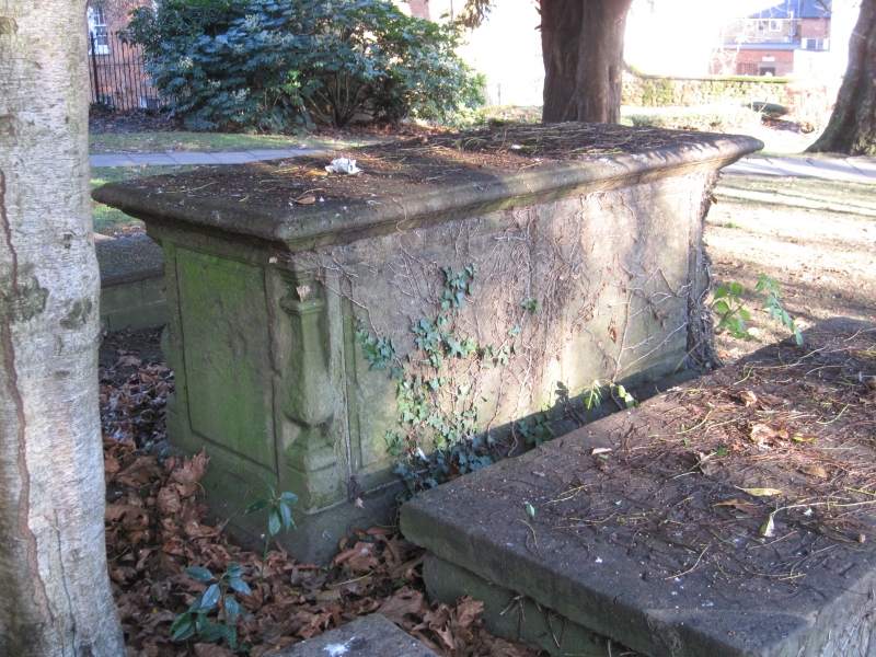
Chest tomb approx. lOm. E of
chancel of Church of St. Mary
GV II
Chest tomb. C18. Ironstone. Corner balusters. Panelled sides. Moulded, chamfered
ledger slab.
Listing NGR: SP4543640552
External links are from the relevant listing authority and, where applicable, Wikidata. Wikidata IDs may be related buildings as well as this specific building. If you want to add or update a link, you will need to do so by editing the Wikidata entry.


Other nearby listed buildings
