Approximate Location Map
Large Map »
Latitude: 52.0617 / 52°3'42"N
Longitude: -1.3406 / 1°20'26"W
OS Eastings: 445302
OS Northings: 240572
OS Grid: SP453405
Mapcode National: GBR 7ST.PW1
Mapcode Global: VHCW7.QF4V
Plus Code: 9C4W3M65+MQ
Entry Name: Wall Approximately 25 Metres South of Friends' Meeting House
Listing Date: 14 February 1986
Grade: II
Source: Historic England
Source ID: 1046951
English Heritage Legacy ID: 244393
ID on this website: 101046951
Location: Banbury, Cherwell, Oxfordshire, OX16
County: Oxfordshire
District: Cherwell
Civil Parish: Banbury
Built-Up Area: Banbury
Traditional County: Oxfordshire
Lieutenancy Area (Ceremonial County): Oxfordshire
Church of England Parish: Banbury St Mary
Church of England Diocese: Oxford
Tagged with: Wall
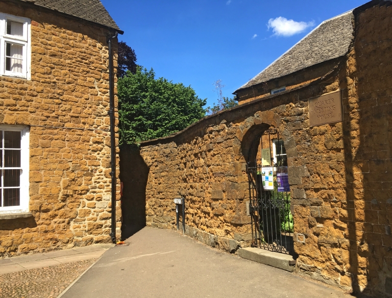
BANBURY HORSE FAIR
SP4540NW (West side)
6/215 Wall approx. 25m. S of
Friends' Meeting House
GV II
Wall. C18. Regular coursed ironstone rubble. Semi-circular arched entrance has
keystoned head. Stone coping swept up to right of entrance. Included for group
value.
Listing NGR: SP4530240572
External links are from the relevant listing authority and, where applicable, Wikidata. Wikidata IDs may be related buildings as well as this specific building. If you want to add or update a link, you will need to do so by editing the Wikidata entry.


Other nearby listed buildings
