Approximate Location Map
Large Map »
Latitude: 51.7539 / 51°45'14"N
Longitude: -1.2525 / 1°15'9"W
OS Eastings: 451694
OS Northings: 206400
OS Grid: SP516064
Mapcode National: GBR 8YY.VJQ
Mapcode Global: VHCXV.75QS
Plus Code: 9C3WQP3W+HX
Entry Name: All Souls College, Boundary Wall
Listing Date: 28 June 1972
Grade: II
Source: Historic England
Source ID: 1046763
English Heritage Legacy ID: 244838
ID on this website: 101046763
Location: Oxford, Oxfordshire, OX1
County: Oxfordshire
District: Oxford
Electoral Ward/Division: Holywell
Parish: Non Civil Parish
Built-Up Area: Oxford
Traditional County: Oxfordshire
Lieutenancy Area (Ceremonial County): Oxfordshire
Church of England Parish: Oxford St Mary the Virgin with St Cross with St Peter-in-the-East,
Church of England Diocese: Oxford
Tagged with: Building
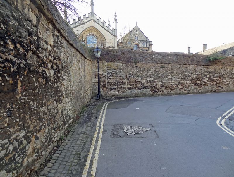
ALL SOUL'S COLLEGE
*.
1485
------------------
Boundary wall on
New College Lane
SP 5106 SE 9/350K
II
2.
C18 or earlier. Rubble wall.
Listing NGR: SP5169406403
External links are from the relevant listing authority and, where applicable, Wikidata. Wikidata IDs may be related buildings as well as this specific building. If you want to add or update a link, you will need to do so by editing the Wikidata entry.


Other nearby listed buildings
