Approximate Location Map
Large Map »
Latitude: 51.7554 / 51°45'19"N
Longitude: -1.2588 / 1°15'31"W
OS Eastings: 451259
OS Northings: 206563
OS Grid: SP512065
Mapcode National: GBR 8YY.SPB
Mapcode Global: VHCXV.44DM
Plus Code: 9C3WQP4R+5F
Entry Name: Balliol College, Range in North West Angle, Garden Quadrangle
Listing Date: 28 June 1972
Grade: II
Source: Historic England
Source ID: 1369624
English Heritage Legacy ID: 244852
ID on this website: 101369624
Location: Oxford, Oxfordshire, OX1
County: Oxfordshire
District: Oxford
Electoral Ward/Division: Carfax
Parish: Non Civil Parish
Built-Up Area: Oxford
Traditional County: Oxfordshire
Lieutenancy Area (Ceremonial County): Oxfordshire
Church of England Parish: Oxford St Mary Magdalen
Church of England Diocese: Oxford
Tagged with: Architectural structure
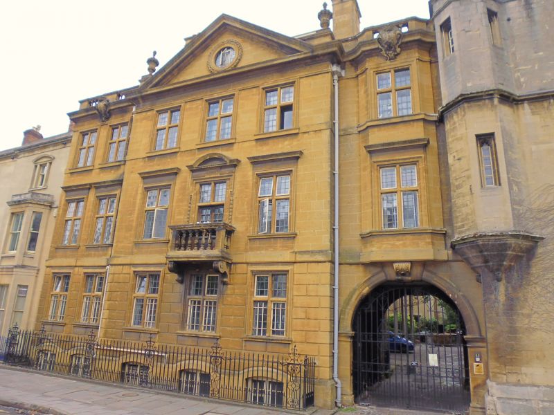
BALLIOL COLLEGE
1.
1485
Garden Quadrangle
Range in North West Angle
SP 5106 NW 5/138A
II
2.
1906 Jacobean by E P Warren in Yellow Guiting stone. Facing St Giles Street
on the West.
Listing NGR: SP5125906563
External links are from the relevant listing authority and, where applicable, Wikidata. Wikidata IDs may be related buildings as well as this specific building. If you want to add or update a link, you will need to do so by editing the Wikidata entry.


Other nearby listed buildings
