Approximate Location Map
Large Map »
Latitude: 51.7495 / 51°44'58"N
Longitude: -1.2529 / 1°15'10"W
OS Eastings: 451670
OS Northings: 205904
OS Grid: SP516059
Mapcode National: GBR 8Z4.81J
Mapcode Global: VHCXV.79H6
Plus Code: 9C3WPPXW+QR
Entry Name: Christchurch, Boundary Wall on East Fronting Merton Grove and Surrounding the Scholars Garden
Listing Date: 28 June 1972
Grade: II
Source: Historic England
Source ID: 1198959
English Heritage Legacy ID: 244898
ID on this website: 101198959
Location: Oxford, Oxfordshire, OX1
County: Oxfordshire
District: Oxford
Electoral Ward/Division: Holywell
Parish: Non Civil Parish
Built-Up Area: Oxford
Traditional County: Oxfordshire
Lieutenancy Area (Ceremonial County): Oxfordshire
Tagged with: Architectural structure
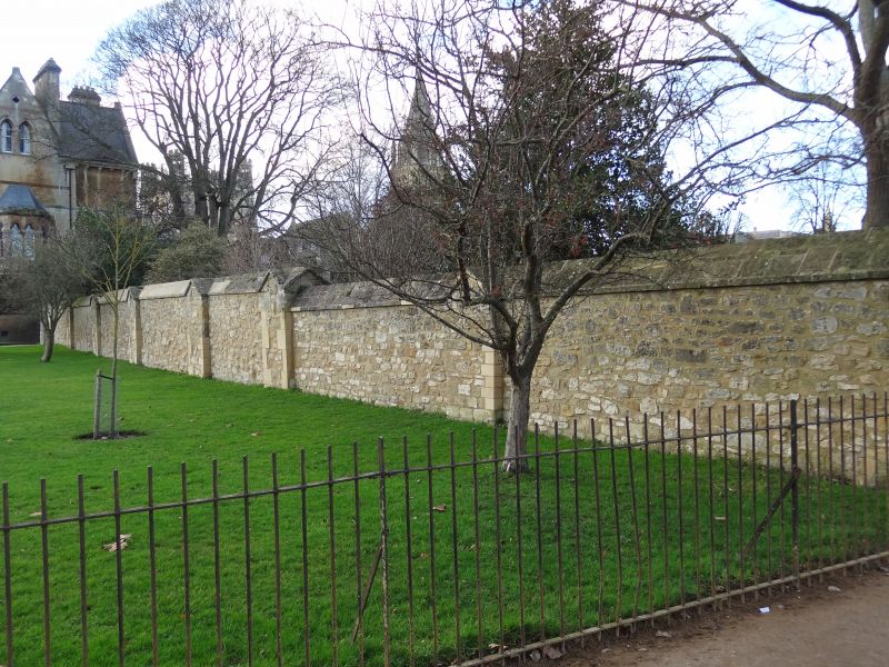
CHRISTCHURCH
1.
1485
------------
Boundary wall on East fronting
Merton Grove and surrounding
the Scholars' Garden
SP 5105 NE 13/650
II
2.
Built 1926. Rubble with triangular coping.
Listing NGR: SP5167005904
External links are from the relevant listing authority and, where applicable, Wikidata. Wikidata IDs may be related buildings as well as this specific building. If you want to add or update a link, you will need to do so by editing the Wikidata entry.


Other nearby listed buildings
