Approximate Location Map
Large Map »
Latitude: 51.7524 / 51°45'8"N
Longitude: -1.2473 / 1°14'50"W
OS Eastings: 452058
OS Northings: 206239
OS Grid: SP520062
Mapcode National: GBR 8Z4.3GR
Mapcode Global: VHCXV.B6HX
Plus Code: 9C3WQQ23+X3
Entry Name: Magdalen College, the Old Grammar Hall
Listing Date: 12 January 1954
Grade: II*
Source: Historic England
Source ID: 1046706
English Heritage Legacy ID: 244989
ID on this website: 101046706
Location: Headington Hill, Oxford, Oxfordshire, OX1
County: Oxfordshire
District: Oxford
Electoral Ward/Division: Holywell
Parish: Non Civil Parish
Built-Up Area: Oxford
Traditional County: Oxfordshire
Lieutenancy Area (Ceremonial County): Oxfordshire
Church of England Parish: Oxford St Mary the Virgin with St Cross with St Peter-in-the-East,
Church of England Diocese: Oxford
Tagged with: Architectural structure
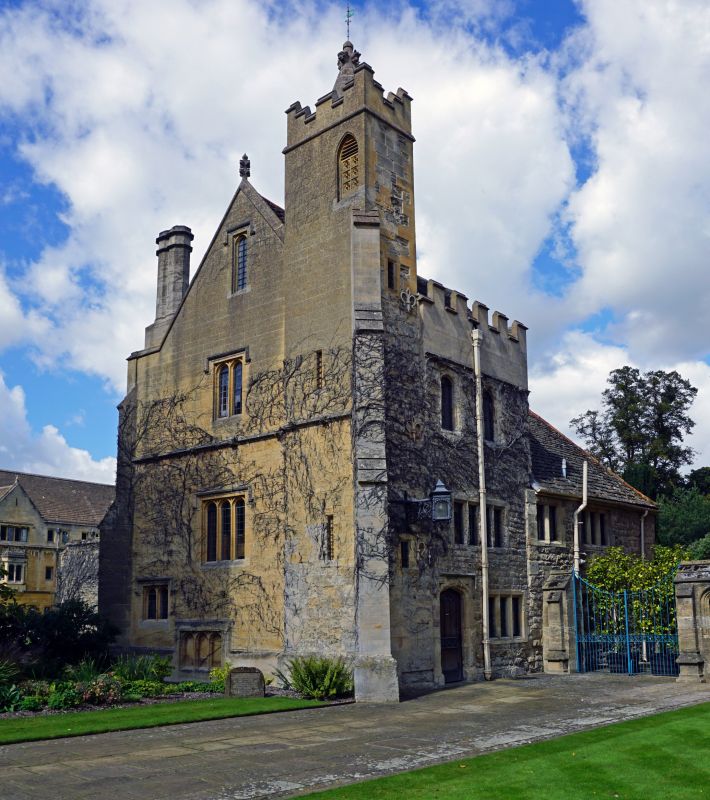
MAGDALEN COLLEGE
1.
1485
The Old Grammar Hall
SP 5206 SW 10/419D 12.1.54.
II*
2.
The surviving part is dated 1614; the bell turret was restored in 1828 and
there was a further restoration on the South in 1849.
Listing NGR: SP5205806239
External links are from the relevant listing authority and, where applicable, Wikidata. Wikidata IDs may be related buildings as well as this specific building. If you want to add or update a link, you will need to do so by editing the Wikidata entry.


Other nearby listed buildings
