Approximate Location Map
Large Map »
Latitude: 51.7565 / 51°45'23"N
Longitude: -1.2536 / 1°15'13"W
OS Eastings: 451614
OS Northings: 206688
OS Grid: SP516066
Mapcode National: GBR 8YY.V5G
Mapcode Global: VHCXV.733S
Plus Code: 9C3WQP4W+JH
Entry Name: Wadham College, East Garden Wall
Listing Date: 12 January 1954
Grade: II
Source: Historic England
Source ID: 1046602
English Heritage Legacy ID: 245202
ID on this website: 101046602
Location: Oxford, Oxfordshire, OX1
County: Oxfordshire
District: Oxford
Electoral Ward/Division: Holywell
Parish: Non Civil Parish
Built-Up Area: Oxford
Traditional County: Oxfordshire
Lieutenancy Area (Ceremonial County): Oxfordshire
Church of England Parish: Oxford St Mary the Virgin with St Cross with St Peter-in-the-East,
Church of England Diocese: Oxford
Tagged with: Building
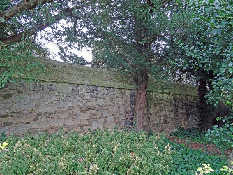
WADHAM COLLEGE
1.
1485
East garden wall
SP 5106 NE 6/187D 12.1.54.
II
2.
On East of Fellows' Garden 1685 at cost of Robert Smith, M D. Mayor of Wells.
Rubble.
Listing NGR: SP5161206692
External links are from the relevant listing authority and, where applicable, Wikidata. Wikidata IDs may be related buildings as well as this specific building. If you want to add or update a link, you will need to do so by editing the Wikidata entry.


Other nearby listed buildings
