Approximate Location Map
Large Map »
Latitude: 51.7614 / 51°45'41"N
Longitude: -1.206 / 1°12'21"W
OS Eastings: 454894
OS Northings: 207267
OS Grid: SP548072
Mapcode National: GBR 8Z0.FX6
Mapcode Global: VHCXP.1ZSL
Plus Code: 9C3WQQ6V+HH
Entry Name: Stone in London Road Outside Number 196
Listing Date: 28 June 1972
Grade: II
Source: Historic England
Source ID: 1369694
English Heritage Legacy ID: 245256
ID on this website: 101369694
Location: Headington Quarry, Oxford, Oxfordshire, OX3
County: Oxfordshire
District: Oxford
Electoral Ward/Division: Quarry and Risinghurst
Parish: Non Civil Parish
Built-Up Area: Oxford
Traditional County: Oxfordshire
Lieutenancy Area (Ceremonial County): Oxfordshire
Church of England Parish: Headington St Andrew
Church of England Diocese: Oxford
Tagged with: Milestone Architectural structure
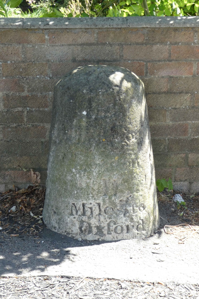
INSCRIBED STONES
1.
1485
Turnpike Milestones
Stone in London Road
outside No 196
SP 5407 18/746
II
2.
The 52nd stone from London. Inscribed 'L 11 Miles from London 11 Miles to
Oxford'.
Listing NGR: SP5489407267
External links are from the relevant listing authority and, where applicable, Wikidata. Wikidata IDs may be related buildings as well as this specific building. If you want to add or update a link, you will need to do so by editing the Wikidata entry.
Other nearby listed buildings


