Approximate Location Map
Large Map »
Latitude: 51.7651 / 51°45'54"N
Longitude: -1.2105 / 1°12'37"W
OS Eastings: 454582
OS Northings: 207670
OS Grid: SP545076
Mapcode National: GBR 8Z0.6SP
Mapcode Global: VHCXN.YWYS
Plus Code: 9C3WQQ8Q+2R
Entry Name: Wall of Mathers Farm Fronting Larkins Lane
Listing Date: 28 June 1972
Grade: II
Source: Historic England
Source ID: 1185015
English Heritage Legacy ID: 245309
ID on this website: 101185015
Location: Headington, Oxford, Oxfordshire, OX3
County: Oxfordshire
District: Oxford
Electoral Ward/Division: Headington
Parish: Non Civil Parish
Built-Up Area: Oxford
Traditional County: Oxfordshire
Lieutenancy Area (Ceremonial County): Oxfordshire
Church of England Parish: Headington St Andrew
Church of England Diocese: Oxford
Tagged with: Wall
BARTON LANE
1.
1485
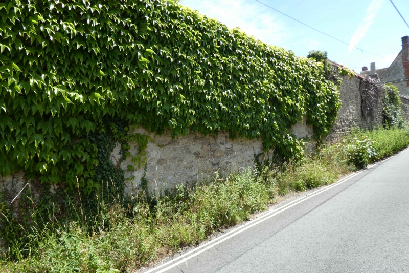
Wall of Mather's Farm
fronting Larkins Lane
SP 5407 18/56A
II
2.
C17. Rubble, brick and stone coping. About 10 ft high.
Listing NGR: SP5458207670
External links are from the relevant listing authority and, where applicable, Wikidata. Wikidata IDs may be related buildings as well as this specific building. If you want to add or update a link, you will need to do so by editing the Wikidata entry.


Other nearby listed buildings
