Approximate Location Map
Large Map »
Latitude: 51.7653 / 51°45'55"N
Longitude: -1.2888 / 1°17'19"W
OS Eastings: 449179
OS Northings: 207640
OS Grid: SP491076
Mapcode National: GBR 7XK.BZ3
Mapcode Global: VHCXM.MW1L
Plus Code: 9C3WQP86+4F
Entry Name: The Thatched Cottage
Listing Date: 28 June 1972
Grade: II
Source: Historic England
Source ID: 1369347
English Heritage Legacy ID: 245334
ID on this website: 101369347
Location: Binsey, Oxford, Oxfordshire, OX2
County: Oxfordshire
District: Oxford
Electoral Ward/Division: Jericho and Osney
Parish: Non Civil Parish
Traditional County: Oxfordshire
Lieutenancy Area (Ceremonial County): Oxfordshire
Church of England Parish: Oxford St Frideswide with Binsey
Church of England Diocese: Oxford
Tagged with: Cottage Thatched cottage
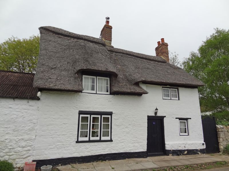
BINSEY
1.
1485
The Thatched Cottage
SP 40 NE 23/684
II
2.
C18. Plastered rubble. 2 storeys, 2 windows, casements. Plain door. Thatched
roof, 2 red brick stacks.
Listing NGR: SP4917907640
External links are from the relevant listing authority and, where applicable, Wikidata. Wikidata IDs may be related buildings as well as this specific building. If you want to add or update a link, you will need to do so by editing the Wikidata entry.


Other nearby listed buildings
