Approximate Location Map
Large Map »
Latitude: 51.7798 / 51°46'47"N
Longitude: -1.2996 / 1°17'58"W
OS Eastings: 448413
OS Northings: 209252
OS Grid: SP484092
Mapcode National: GBR 7XC.88N
Mapcode Global: VHCXM.FJ9F
Plus Code: 9C3WQPH2+W4
Entry Name: Little Godstow Bridge
Listing Date: 28 June 1972
Grade: II
Source: Historic England
Source ID: 1116442
English Heritage Legacy ID: 245453
ID on this website: 101116442
Location: Lower Wolvercote, Oxford, Oxfordshire, OX2
County: Oxfordshire
District: Oxford
Electoral Ward/Division: Wolvercote
Parish: Non Civil Parish
Traditional County: Oxfordshire
Lieutenancy Area (Ceremonial County): Oxfordshire
Church of England Parish: Wolvercote
Church of England Diocese: Oxford
Tagged with: Road bridge
GODSTOW ROAD
1.
1485
(South Side)
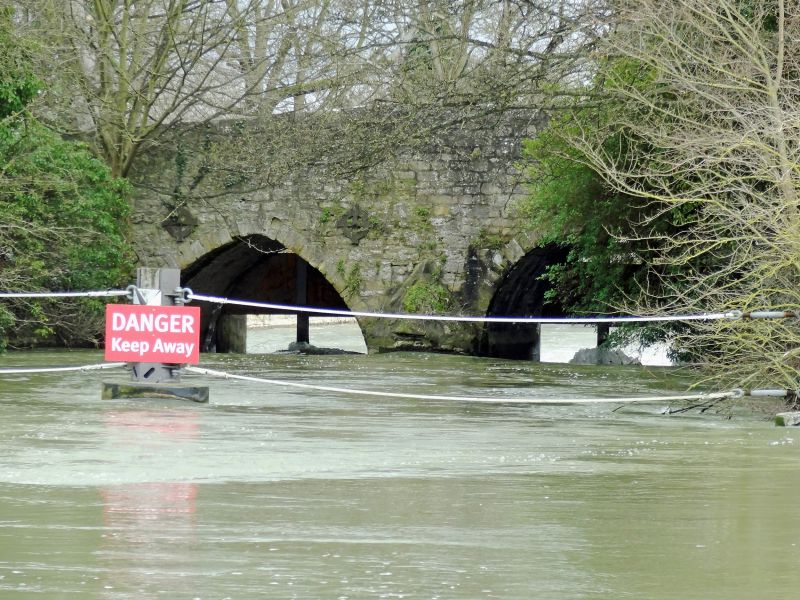
Little Godstow Bridge
SP 4809 10/723
II
2.
Probably medieval in origin but rebuilt and dated 1892. Ashlar voussoirs,
the rest coursed rubble. 2 arches.
Listing NGR: SP4841309252
External links are from the relevant listing authority and, where applicable, Wikidata. Wikidata IDs may be related buildings as well as this specific building. If you want to add or update a link, you will need to do so by editing the Wikidata entry.


Other nearby listed buildings
