Approximate Location Map
Large Map »
Latitude: 51.7526 / 51°45'9"N
Longitude: -1.2528 / 1°15'10"W
OS Eastings: 451676
OS Northings: 206250
OS Grid: SP516062
Mapcode National: GBR 8Z4.22M
Mapcode Global: VHCXV.76KT
Plus Code: 9C3WQP3W+2V
Entry Name: 90, High Street
Listing Date: 12 January 1954
Grade: II
Source: Historic England
Source ID: 1369387
English Heritage Legacy ID: 245521
ID on this website: 101369387
Location: Oxford, Oxfordshire, OX1
County: Oxfordshire
District: Oxford
Electoral Ward/Division: Holywell
Parish: Non Civil Parish
Built-Up Area: Oxford
Traditional County: Oxfordshire
Lieutenancy Area (Ceremonial County): Oxfordshire
Church of England Parish: Oxford St Mary the Virgin with St Cross with St Peter-in-the-East,
Church of England Diocese: Oxford
Tagged with: Building
HIGH STREET
1.
1485
(South Side)
No 90
SP 5106 SE 9/360 12.1.54
II GV
2.
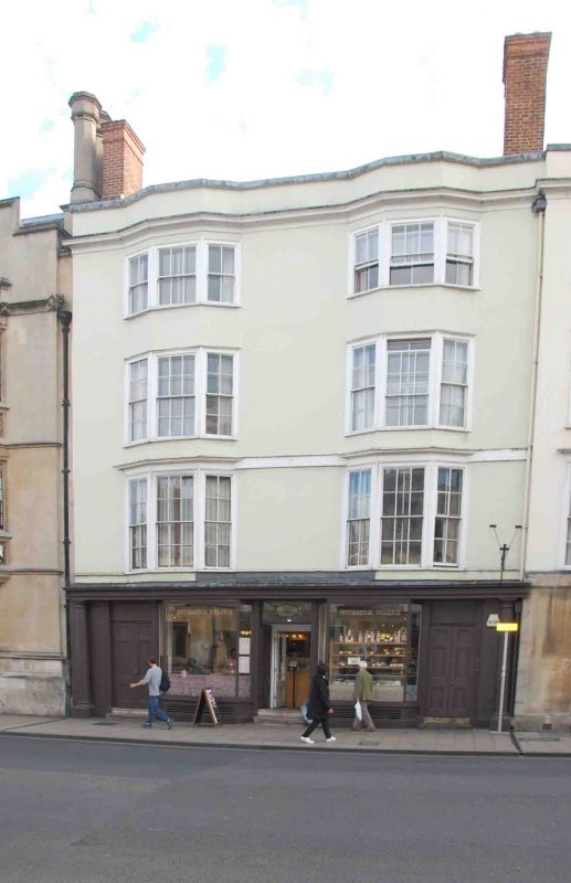
House and shop. RCHM 64. Early Cl7 and refronted in Cl8-19. 4-storeyed
stucccoed Otimbber--framing with cellars, a moulded eaves cornice, parapet,
Welsh slate roof and brick stacks. Carried up throu the uppeer flrs are
22 bay windo s with 3-light sash windows. On the ground floor on each side
of the shop is a d oru in a reeded rame flae d by aan engaged Doric column.
6-panel doors in a pair. Late Cl9 shop. Roof not visible. Interior. RCHM
p 163 b. Includes a blocked original doorway and a partly renewed staircase;
a plaster ceiling with moulded ornamented beams; original panelling, fireplaces
and over-mantels. At the back is an addition (now a lecture room of University
College) built by James Adam, a cabinet maker, circa 1812; it has 2 Venetian
windows. History. Built in 16l2 by John Williams apothecary and refronted
by James Adam, probably early in Cl9. In 1905 it was acquired by University
College of which it is now part. Here lodged the mother of John Ruskin when
he was at Christ Church, 1836-40.
All the listed buildings on the South Side form a group.
Listing NGR: SP5167406247
External links are from the relevant listing authority and, where applicable, Wikidata. Wikidata IDs may be related buildings as well as this specific building. If you want to add or update a link, you will need to do so by editing the Wikidata entry.


Other nearby listed buildings
