Approximate Location Map
Large Map »
Latitude: 51.7495 / 51°44'58"N
Longitude: -1.2596 / 1°15'34"W
OS Eastings: 451210
OS Northings: 205906
OS Grid: SP512059
Mapcode National: GBR 8Z4.6CD
Mapcode Global: VHCXV.39Y5
Plus Code: 9C3WPPXR+R5
Entry Name: Garden Wall of Number 15
Listing Date: 28 June 1972
Grade: II
Source: Historic England
Source ID: 1047207
English Heritage Legacy ID: 245615
ID on this website: 101047207
Location: Oxford, Oxfordshire, OX1
County: Oxfordshire
District: Oxford
Electoral Ward/Division: Carfax
Parish: Non Civil Parish
Built-Up Area: Oxford
Traditional County: Oxfordshire
Lieutenancy Area (Ceremonial County): Oxfordshire
Church of England Parish: Oxford St Ebbe with Holy Trinity and St Peter le Bailey
Church of England Diocese: Oxford
Tagged with: Wall
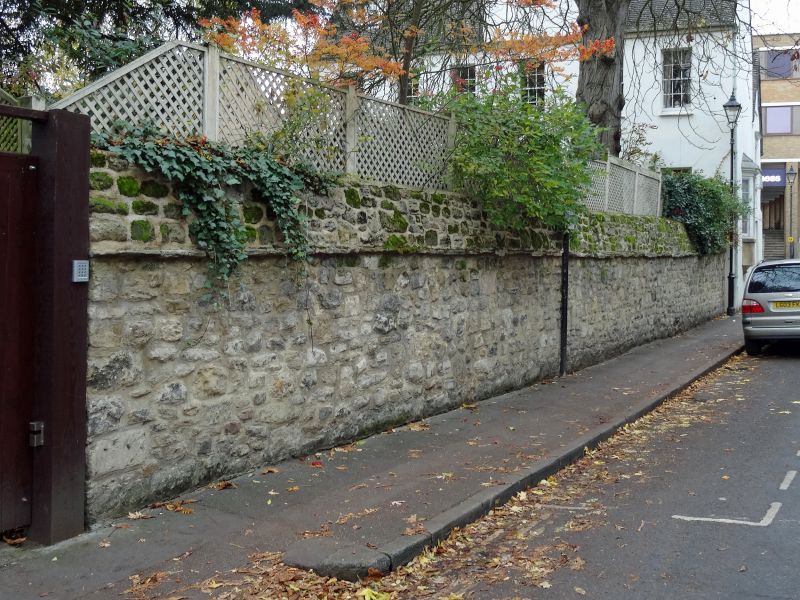
LITTLEGATE STREET
1.
1485
Garden wall of
No 15
SP 5105 NW 12/547A
II
2.
C17. Rubble wall with triangular coping.
Listing NGR: SP5121005906
External links are from the relevant listing authority and, where applicable, Wikidata. Wikidata IDs may be related buildings as well as this specific building. If you want to add or update a link, you will need to do so by editing the Wikidata entry.


Other nearby listed buildings
