Approximate Location Map
Large Map »
Latitude: 51.7514 / 51°45'5"N
Longitude: -1.2383 / 1°14'17"W
OS Eastings: 452680
OS Northings: 206132
OS Grid: SP526061
Mapcode National: GBR 8Z4.5RW
Mapcode Global: VHCXV.H77P
Plus Code: 9C3WQQ26+HM
Entry Name: 10, London Place
Listing Date: 28 June 1972
Grade: II
Source: Historic England
Source ID: 1047209
English Heritage Legacy ID: 245618
ID on this website: 101047209
Location: Headington Hill, Oxford, Oxfordshire, OX4
County: Oxfordshire
District: Oxford
Electoral Ward/Division: St Clement's
Parish: Non Civil Parish
Built-Up Area: Oxford
Traditional County: Oxfordshire
Lieutenancy Area (Ceremonial County): Oxfordshire
Church of England Parish: Oxford St Clement
Church of England Diocese: Oxford
Tagged with: Building
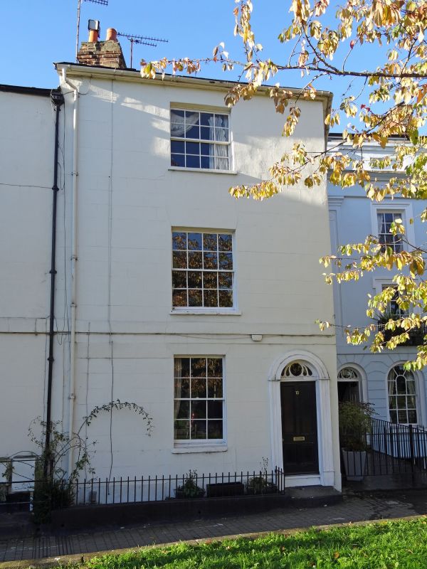
LONDON PLACE
1.
1485
No 10
SP 5206 SE 11/762
II GV
2.
Early Cl9. Rendered. Corner building with 1 window on each face. 3 storeys.
Sash windows with glazing bars. Slate roof.
Nos 6 to 16 (consec) form a group.
Listing NGR: SP5268006132
External links are from the relevant listing authority and, where applicable, Wikidata. Wikidata IDs may be related buildings as well as this specific building. If you want to add or update a link, you will need to do so by editing the Wikidata entry.


Other nearby listed buildings
