Approximate Location Map
Large Map »
Latitude: 51.7551 / 51°45'18"N
Longitude: -1.259 / 1°15'32"W
OS Eastings: 451245
OS Northings: 206525
OS Grid: SP512065
Mapcode National: GBR 8YY.SN5
Mapcode Global: VHCXV.448W
Plus Code: 9C3WQP4R+2C
Entry Name: The Martyrs Memorial
Listing Date: 12 January 1954
Grade: II*
Source: Historic England
Source ID: 1107172
English Heritage Legacy ID: 245634
ID on this website: 101107172
Location: Oxford, Oxfordshire, OX1
County: Oxfordshire
District: Oxford
Electoral Ward/Division: Carfax
Parish: Non Civil Parish
Built-Up Area: Oxford
Traditional County: Oxfordshire
Lieutenancy Area (Ceremonial County): Oxfordshire
Church of England Parish: Oxford St Mary Magdalen
Church of England Diocese: Oxford
Tagged with: Memorial
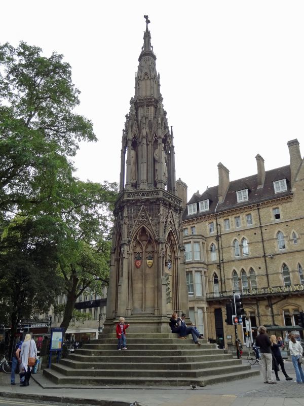
MAGDALEN STREET
1.
148
The Martyrs' Memorial
SP 5106 NW 5/136 12.1.54.
II*
2.
By Sir Gilbert Scott, 1841. Repaired circa 1920 and cleaned and partly restored
1949. Built in Permian dolomite and Bath stone. It is a Gothic design
of the Queen Eleanor Cross type. Forms the Southern terminal to St Giles'
street.
Listing NGR: SP5124506525
External links are from the relevant listing authority and, where applicable, Wikidata. Wikidata IDs may be related buildings as well as this specific building. If you want to add or update a link, you will need to do so by editing the Wikidata entry.


Other nearby listed buildings
