Approximate Location Map
Large Map »
Latitude: 51.7585 / 51°45'30"N
Longitude: -1.2587 / 1°15'31"W
OS Eastings: 451263
OS Northings: 206903
OS Grid: SP512069
Mapcode National: GBR 8YY.LMC
Mapcode Global: VHCXV.42F8
Plus Code: 9C3WQP5R+9G
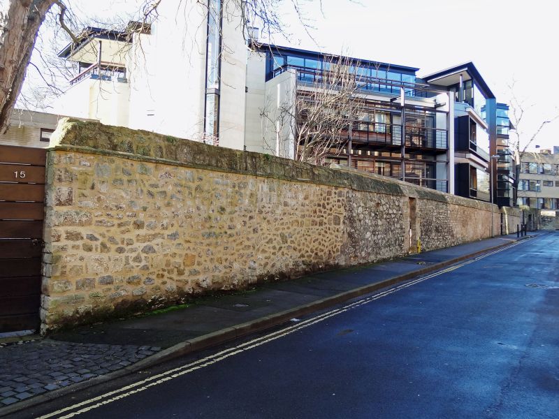
Entry Name: Boundary Wall of Black Hall Fronting Black Hall Road
Listing Date: 28 June 1972
Grade: II
Source: Historic England
Source ID: 1047138
English Heritage Legacy ID: 245824
ID on this website: 101047138
Location: Norham Manor, Oxford, Oxfordshire, OX1
County: Oxfordshire
District: Oxford
Electoral Ward/Division: Carfax
Parish: Non Civil Parish
Built-Up Area: Oxford
Traditional County: Oxfordshire
Lieutenancy Area (Ceremonial County): Oxfordshire
Church of England Parish: Oxford St Giles
Church of England Diocese: Oxford
Tagged with: Wall
ST GILES' STREET
1.
1485
(East Side)
Boundary wall of
Black Hall fronting
Black Hall Road
SP 5l06 NW 5/532B
II
2.
Medieval and later rubble wall with triangular coping.
Listing NGR: SP5125606903
External links are from the relevant listing authority and, where applicable, Wikidata. Wikidata IDs may be related buildings as well as this specific building. If you want to add or update a link, you will need to do so by editing the Wikidata entry.


Other nearby listed buildings
