Approximate Location Map
Large Map »
Latitude: 51.5473 / 51°32'50"N
Longitude: -0.9149 / 0°54'53"W
OS Eastings: 475337
OS Northings: 183710
OS Grid: SU753837
Mapcode National: GBR C4K.X3J
Mapcode Global: VHDWG.3C5Q
Plus Code: 9C3XG3WP+W2
Entry Name: 36, Fairmile
Listing Date: 28 October 1974
Grade: II
Source: Historic England
Source ID: 1369513
English Heritage Legacy ID: 246101
ID on this website: 101369513
Location: South Oxfordshire, RG9
County: Oxfordshire
District: South Oxfordshire
Civil Parish: Henley-on-Thames
Built-Up Area: Henley-on-Thames
Traditional County: Oxfordshire
Lieutenancy Area (Ceremonial County): Oxfordshire
Church of England Parish: Henley-on-Thames
Church of England Diocese: Oxford
Tagged with: Building
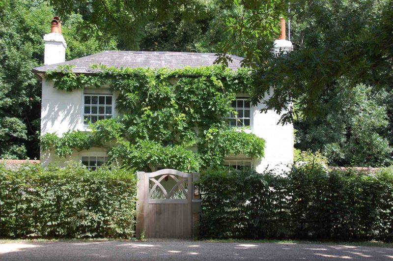
1. FAIRMILE
5355 (North East Side)
No 36
SU 7583 4/248
II GV
2.
Early C19. White painted brick with hipped slate roof. 2 storeys, 2
windows, sashes with cambered head linings and glazing bars. Centre door
with modern porch.
Listing NGR: SU7533783710
External links are from the relevant listing authority and, where applicable, Wikidata. Wikidata IDs may be related buildings as well as this specific building. If you want to add or update a link, you will need to do so by editing the Wikidata entry.


Other nearby listed buildings
