Approximate Location Map
Large Map »
Latitude: 51.7765 / 51°46'35"N
Longitude: -1.239 / 1°14'20"W
OS Eastings: 452599
OS Northings: 208918
OS Grid: SP525089
Mapcode National: GBR 8YR.KKJ
Mapcode Global: VHCXN.GMV0
Plus Code: 9C3WQQG6+H9
Entry Name: Cromwells House
Listing Date: 5 June 1985
Grade: II
Source: Historic England
Source ID: 1047566
English Heritage Legacy ID: 246662
ID on this website: 101047566
Location: Marston, Oxford, Oxfordshire, OX3
County: Oxfordshire
District: Oxford
Civil Parish: Old Marston
Built-Up Area: Oxford
Traditional County: Oxfordshire
Lieutenancy Area (Ceremonial County): Oxfordshire
Church of England Parish: Marston
Church of England Diocese: Oxford
Tagged with: House
This list entry was subject to a Minor Amendment on 11/05/2020
SP50NW
4/142
MARSTON
Old Marston
MILL LANE (east side)
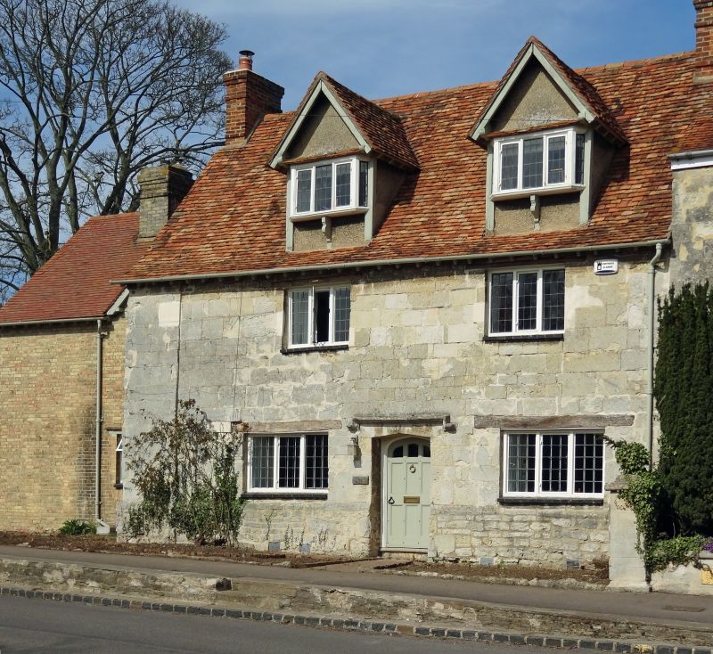
No.17 (Cromwells House)
18/07/63
GV
II
Manor house, now house. Early/mid C17, possibly partly earlier, extended early C20. Coursed squared limestone rubble with timber lintels; old plain-tile roof with brick gable stacks. Two-unit through-passage plan. Two storeys plus attics. Two-window front, with chamfered plinth, has central triangular-headed doorway with label and three-light leaded casements at ground and first floors. The two gabled roof dormers with canted bay windows on moulded cills and brackets do not appear on early views of he house. To left, set back, and to rear are C20 buff-brick extensions.
Interior: oak screen, to left of passage, with ovolo-moulded framing and Tudor-arched doorway with foliage-carved spandrels; stone arched fireplace with recessed spandrels and cast-iron fireback of 1649; re-set four-centre arched doorway with recessed spandrels and ribbed oak door.
Part of the Manor house noted as having been built by Unton Croke and used as Fairfax's headquarters during the siege of Oxford in 1645. The treaty for the surrender of Oxford was signed there in 1646. See also No.15 Mill Lane (Manor House).
Listing NGR: SP5259908918
External links are from the relevant listing authority and, where applicable, Wikidata. Wikidata IDs may be related buildings as well as this specific building. If you want to add or update a link, you will need to do so by editing the Wikidata entry.


Other nearby listed buildings
