Approximate Location Map
Large Map »
Latitude: 51.8031 / 51°48'11"N
Longitude: -1.2257 / 1°13'32"W
OS Eastings: 453483
OS Northings: 211886
OS Grid: SP534118
Mapcode National: GBR 8YD.WFP
Mapcode Global: VHCXG.PYV4
Plus Code: 9C3WRQ3F+6P
Entry Name: Church of the Holy Rood, Headstone Approximately 10 Metres to South
Listing Date: 5 June 1985
Grade: II
Source: Historic England
Source ID: 1369222
English Heritage Legacy ID: 246753
ID on this website: 101369222
Location: Holy Rood Church, Woodeaton, South Oxfordshire, OX3
County: Oxfordshire
District: South Oxfordshire
Civil Parish: Woodeaton
Traditional County: Oxfordshire
Lieutenancy Area (Ceremonial County): Oxfordshire
Church of England Parish: Woodeaton
Church of England Diocese: Oxford
Tagged with: Tombstone
WOODEATON
SP51SW
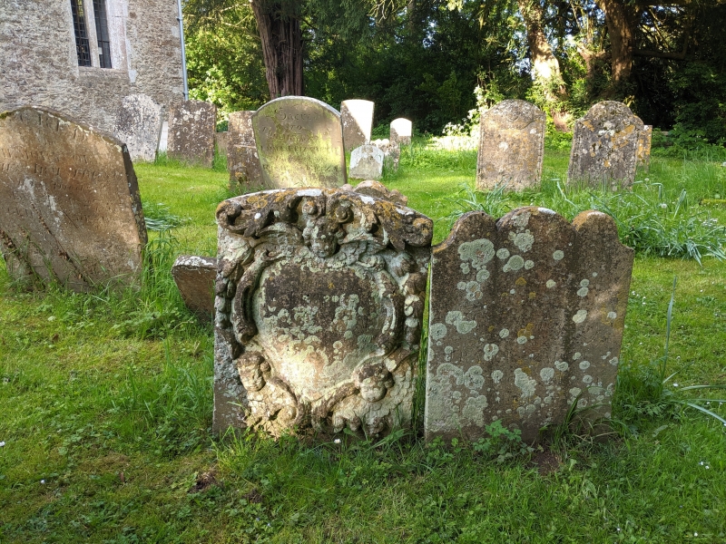
1/232 Church of the Holy Rood,
headstone approx. 10m. to S
GV II
Headstone. Inscribed 1700. Limestone. Segmental-topped stone has
vigorously-carved baroque cartouche with scrolls, cherubs and festoons.
Inscription commemorates Mary wife of Francis (?).
Listing NGR: SP5348211890
External links are from the relevant listing authority and, where applicable, Wikidata. Wikidata IDs may be related buildings as well as this specific building. If you want to add or update a link, you will need to do so by editing the Wikidata entry.


Other nearby listed buildings
