Approximate Location Map
Large Map »
Latitude: 51.5304 / 51°31'49"N
Longitude: -0.9577 / 0°57'27"W
OS Eastings: 472396
OS Northings: 181794
OS Grid: SU723817
Mapcode National: GBR C4P.YHF
Mapcode Global: VHDWF.CS1N
Plus Code: 9C3XG2JR+5W
Entry Name: Cross Lanes Farmhouse
Listing Date: 13 February 1985
Grade: II
Source: Historic England
Source ID: 1047389
English Heritage Legacy ID: 247142
ID on this website: 101047389
Location: Rotherfield Greys, South Oxfordshire, RG9
County: Oxfordshire
District: South Oxfordshire
Civil Parish: Rotherfield Greys
Traditional County: Oxfordshire
Lieutenancy Area (Ceremonial County): Oxfordshire
Church of England Parish: Rotherfield Peppard
Church of England Diocese: Oxford
Tagged with: Farmhouse
SU78SW
6/120
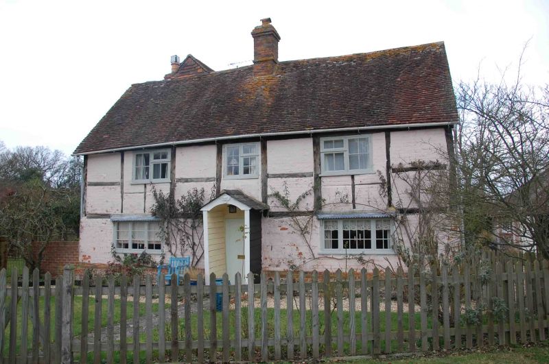
ROTHERFIELD GREYS
Cross Lanes Farmhouse
II
Farmhouse now house. Early C18. Timber-framed, painted brick infill, plain
tile roof, centre right brick stack. 2-storey, 3-window range. Irregular
C19 casements to all openings. Central plank door with gabled tiled porch.
C20 extension to rear. Interior not inspected.
Listing NGR: SU7239681794
External links are from the relevant listing authority and, where applicable, Wikidata. Wikidata IDs may be related buildings as well as this specific building. If you want to add or update a link, you will need to do so by editing the Wikidata entry.


Other nearby listed buildings
