Approximate Location Map
Large Map »
Latitude: 51.5451 / 51°32'42"N
Longitude: -0.9546 / 0°57'16"W
OS Eastings: 472587
OS Northings: 183430
OS Grid: SU725834
Mapcode National: GBR C4P.5FL
Mapcode Global: VHDWF.DFPC
Plus Code: 9C3XG2WW+24
Entry Name: Greys Court, Inner Walls of Kitchen Garden
Listing Date: 13 February 1985
Grade: II
Source: Historic England
Source ID: 1181261
English Heritage Legacy ID: 247151
ID on this website: 101181261
Location: Greys Green, South Oxfordshire, RG9
County: Oxfordshire
District: South Oxfordshire
Civil Parish: Rotherfield Greys
Traditional County: Oxfordshire
Lieutenancy Area (Ceremonial County): Oxfordshire
Church of England Parish: Rotherfield Greys
Church of England Diocese: Oxford
Tagged with: Kitchen garden
ROTHERFIELD GREYS
SU78SW
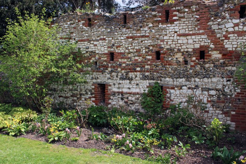
6/129 Greys Court, inner walls of
kitchen garden
GV II
Walls. C17, C18, C19, C20. Flint; flint and brick; brick. Walls forming
irregular cells in kitchen garden area. Included for group value.
Listing NGR: SU7258783431
External links are from the relevant listing authority and, where applicable, Wikidata. Wikidata IDs may be related buildings as well as this specific building. If you want to add or update a link, you will need to do so by editing the Wikidata entry.


Other nearby listed buildings
