Approximate Location Map
Large Map »
Latitude: 51.5138 / 51°30'49"N
Longitude: -1.0634 / 1°3'48"W
OS Eastings: 465089
OS Northings: 179845
OS Grid: SU650798
Mapcode National: GBR B3M.1YT
Mapcode Global: VHCZ3.J65V
Plus Code: 9C3WGW7P+GJ
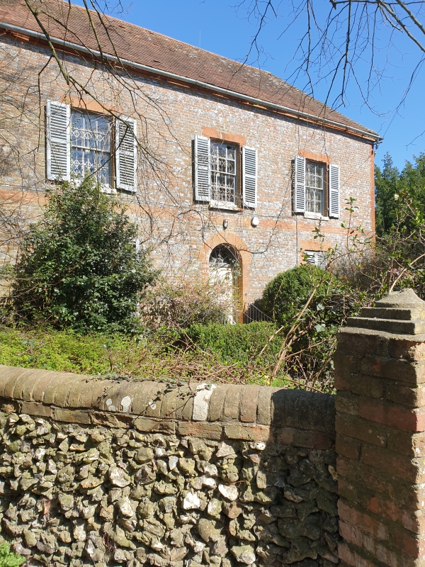
Entry Name: Newhouse Farmhouse
Listing Date: 16 August 1985
Grade: II
Source: Historic England
Source ID: 1194268
English Heritage Legacy ID: 247304
ID on this website: 101194268
Location: Goring Heath, South Oxfordshire, RG8
County: Oxfordshire
District: South Oxfordshire
Civil Parish: Goring Heath
Traditional County: Oxfordshire
Lieutenancy Area (Ceremonial County): Oxfordshire
Church of England Parish: Goring
Church of England Diocese: Oxford
Tagged with: Farmhouse
GORING HEATH B4526
SU67NE (North side)
9/86 Newhouse Farmhouse
- II
Farmhouse. Probably mid C18. Grey brick with red brick dressings; plain tile
hipped roof; brick stacks to rear. 2 storeys; 3-window range. Central 6-panel
door with decorative fanlight. 12-pane sashes to all openings. Interior not
inspected.
Listing NGR: SU6508979845
External links are from the relevant listing authority and, where applicable, Wikidata. Wikidata IDs may be related buildings as well as this specific building. If you want to add or update a link, you will need to do so by editing the Wikidata entry.


Other nearby listed buildings
